Willkommen bei MapFox
Wurde Ihre Bestellung bestätigt? Wenn nicht - gab es evtl. ein SERVER-Problem! Bitte kontaktieren Sie uns! +++ Buchhändler-Anfragen erwünscht +++
Warenkorb
Artikel: 0 - € 0.00
Zur Kasse
Impressum Kontakt Versandkosten AGB
Spanien: Wanderkarten Pyrenäen - RANDO EDITION
<< Spanien: Wanderkarten
 

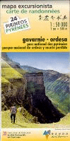
Französisch-Spanische topografische Wanderkartenserie über die Pyrenäen im Maßstab 1:50.000. Die Höhenlinien liegen im 20 m-Abstand. Die markierten Wanderwege sind exakt eingezeichnet.
Die Legende liegt in französischer und spanischer Sprache vor.

Westteil Ostteil

Kartenbeispiel

Produkt EUR Anzahl Bestellen
CoverPyrenäen Frankreich / Spanien (Blatt 00) 1:400.000
Pirénées France / Espagne - Pirineos Espana / Francia Rando Edition Details...
Gelbes Karosymbol 15.90
Versandkostenfrei in Deutschland ab 30,- Bestellwert

incl. MwSt.
Cover1 Pays basque ouest - Labourd - Basse-Navarre carte de randonnées 1:50.000 (Pyrénées carte no. 1) - Pyrenäen-Wanderkarte RANDO EDITIONS Details...
Grünes Karosymbol 17.90
Versandkostenfrei in Deutschland ab 30,- Bestellwert

incl. MwSt.
Cover2 Pays basque est Carte de randonnées 1:50.000 (Pyrénées carte no. 2) - Pyrenäen-Wanderkarte RANDO EDITIONS Details...
Grünes Karosymbol 17.90
Versandkostenfrei in Deutschland ab 30,- Bestellwert

incl. MwSt.
Cover3 Béarn - Aspe, Ossau, Parc National des Pyrénées carte de randonnées 1:50.000 (Pyrénées carte no. 3) - Pyrenäen-Wanderkarte RANDO EDITIONS Details...
Grünes Karosymbol 17.90
Versandkostenfrei in Deutschland ab 30,- Bestellwert

incl. MwSt.
Cover4 Bigorre - Cauterets - Gavarnie - St-Lary-Soulan - Parc National des Pyrénées carte de randonnées 1:50.000 (Pyrénées carte no. 4) - Pyrenäen-Wanderkarte RANDO EDITIONS Details...
Grünes Karosymbol 17.90
Versandkostenfrei in Deutschland ab 30,- Bestellwert

incl. MwSt.
Cover5 Luchon - Comminges - Louron carte de randonnées 1:50.000 (Pyrénées carte no. 5) - Pyrenäen-Wanderkarte RANDO EDITIONS Details...
Grünes Karosymbol 17.90
Versandkostenfrei in Deutschland ab 30,- Bestellwert

incl. MwSt.
Cover6 Couserans - Valier - Maubermé carte de randonnées 1:50.000 (Pyrénées carte no. 6) - Pyrenäen-Wanderkarte RANDO EDITIONS Details...
Grünes Karosymbol 17.90
Versandkostenfrei in Deutschland ab 30,- Bestellwert

incl. MwSt.
Cover7 Haute-Ariège - Vicdessos - Orlu carte de randonnées 1:50.000 (Pyrénées carte no. 7) - Pyrenäen-Wanderkarte RANDO EDITIONS Details...
Grünes Karosymbol 17.90
Versandkostenfrei in Deutschland ab 30,- Bestellwert

incl. MwSt.
Cover8 Cerdagne - Capcir - Font-Romeu - Ax-les-Thermes carte de randonnées 1:50.000 (Pyrénées carte no. 8) - Pyrenäen-Wanderkarte RANDO EDITIONS Details...
Grünes Karosymbol 17.90
Versandkostenfrei in Deutschland ab 30,- Bestellwert

incl. MwSt.
Cover9 Sentier Cathare - Quéribus - Peyrepertuse - Puylaurens - Montségur carte de randonnées 1:55.000 (Pyrénées carte no. 9) - Pyrenäen-Wanderkarte RANDO EDITIONS Details...
Grünes Karosymbol 17.90
Versandkostenfrei in Deutschland ab 30,- Bestellwert

incl. MwSt.
Cover10 Canigou - Carrotxa carte de randonnées 1:50.000 (Pyrénées carte no. 10) - Pyrenäen-Wanderkarte RANDO EDITIONS Details...
Grünes Karosymbol 17.90
Versandkostenfrei in Deutschland ab 30,- Bestellwert

incl. MwSt.
Cover11 Collioure-Cadaqués - Massif des Albères - Côte Vermeille - Cap de Creus carte de randonnées 1:50.000 (Pyrénées carte no. 11) - Pyrenäen-Wanderkarte RANDO EDITIONS Details...
Grünes Karosymbol 17.90
Versandkostenfrei in Deutschland ab 30,- Bestellwert

incl. MwSt.
Cover12 Gavarnie - Ordesa carte de randonnées 1:50.000 (Pyrénées carte no. 11) - Pyrenäen-Wanderkarte RANDO EDITIONS
Pyréenées Gavarnie/Ordesa - 1/50 000 Dieser Titel ist momentan nicht lieferbar. Details...
Rotes Karosymbol 17.90
Versandkostenfrei in Deutschland ab 30,- Bestellwert

incl. MwSt.
Cover13 Aneto-Posets - Bachimala - Cotiella - Turbon carte de randonnées 1:50.000 (Pyrénées carte no. 13) - Pyrenäen-Wanderkarte RANDO EDITIONS
13 Pyréenées Aneto-Posets Details...
Grünes Karosymbol 17.90
Versandkostenfrei in Deutschland ab 30,- Bestellwert

incl. MwSt.
Cover14 Sierra de Guara - Parque Natural de la Sierra y Cañones de Guara Pyrenäen-Wanderkarte 1:50.000
14 Pyréenées Sierra de Guara - carte de randonnées RANDO EDITIONS Spanien Details...
Gelbes Karosymbol 17.90
Versandkostenfrei in Deutschland ab 30,- Bestellwert

incl. MwSt.
Cover21 Andorra - Cadí (Parc Natural del Cadí-Moixeró) - mapa excursionista 1:50.000 (Pirineos) - Pyrenäen-Wanderkarte RANDO EDITIONS Dieser Titel ist momentan nicht lieferbar. Details...
Rotes Karosymbol 17.90
Versandkostenfrei in Deutschland ab 30,- Bestellwert

incl. MwSt.
Cover25 Ansó - Hecho (Orhy - Roncal - Anie - Bisaurín) - mapa excursionista 1:50.000 (Pirineos) - Pyrenäen-Wanderkarte RANDO EDITIONS Dieser Titel ist momentan nicht lieferbar. Details...
Rotes Karosymbol 17.90
Versandkostenfrei in Deutschland ab 30,- Bestellwert

incl. MwSt.


Zuletzt angesehene Artikel:

Cover56 Topographische Landkarte Wanderkarte und Fahrradkarte Portugal 1:25.000
056 Mapa topográfico - Mapa de caminhadas - Portugal 1:25.000 ProjektNord

Cover1014 07 Styrskär Topographische Karte 1:20.000 (Maastokartta / Peruskartta / Grundkarta) Maanmittauslaitos / Lantmäteriverket Finnland - ProjektNord

Cover514 Taravilla Amtliche topographische Landkarte 1:50.000 Spanien (M.T.N.)
514 Mapa Topográfico Nacional de Espana (MTN50) Instituto Geográfico Nacional - CNIG Spanien

Noch kein Cover vorhandenSokolka West Topographische Karte 1:25.000 Messtischblatt des Deutschen Reiches - Preußische Landesaufnahme / Reichsamt für Landesaufnahme - Faksimile ProjektNord

Cover5170 Brieg Topographische Karte 1:25.000 Messtischblatt des Deutschen Reiches - Preußische Landesaufnahme / Reichsamt für Landesaufnahme - Faksimile ProjektNord

CoverSyktywkar Stadtplan 1:25.000 - Russland
Siktivkar

Noch kein Cover vorhanden5271 Löwen Topographische Karte 1:25.000 Messtischblatt des Deutschen Reiches - Preußische Landesaufnahme / Reichsamt für Landesaufnahme - Faksimile ProjektNord

Noch kein Cover vorhanden5678 Hindenburg Topographische Karte 1:25.000 Messtischblatt des Deutschen Reiches - Preußische Landesaufnahme / Reichsamt für Landesaufnahme - Faksimile ProjektNord

Noch kein Cover vorhanden5475 Gr. Strehlitz Topographische Karte 1:25.000 Messtischblatt des Deutschen Reiches - Preußische Landesaufnahme / Reichsamt für Landesaufnahme - Faksimile ProjektNord

Cover5523 Neuhof Topographische Landkarte Hessen 1:25.000 - ProjektNord (geplottete Ausgabe)

Noch kein Cover vorhanden5057 Wigandsthal Topographische Karte 1:25.000 Messtischblatt des Deutschen Reiches - Preußische Landesaufnahme / Reichsamt für Landesaufnahme - Faksimile ProjektNord

Noch kein Cover vorhanden5766 Wölfelsdorf Topographische Karte 1:25.000 Messtischblatt des Deutschen Reiches - Preußische Landesaufnahme / Reichsamt für Landesaufnahme - Faksimile ProjektNord

Cover5106 Kerpen (geplottete Ausgabe) Amtliche topographische Karte 1:25.000 Landesvermessungsamt Nordrhein-Westfalen

Cover5614 Limburg an der Lahn Topographische Landkarte Hessen 1:25.000 - ProjektNord (geplottete Ausgabe)

Noch kein Cover vorhanden5467 Kamenz in Niederschlesien Topographische Karte 1:25.000 Messtischblatt des Deutschen Reiches - Preußische Landesaufnahme / Reichsamt für Landesaufnahme - Faksimile ProjektNord

Noch kein Cover vorhanden5377 Pawonkau Topographische Karte 1:25.000 Messtischblatt des Deutschen Reiches - Preußische Landesaufnahme / Reichsamt für Landesaufnahme - Faksimile ProjektNord

Cover182 St Albans & Hatfield - Wanderkarte Großbritannien 1:25.000 EXPLORER MAP - Active Map LAMINIERT - Ordnance Survey

CoverSkyros Touristische Landkarte - Straßenkarte - Griechische Inseln 1:50.000
Σκύρος - Skyros - Mini Map `Orange Blue` Orama - Griechenland

CoverSF 529 Linz - Stadtführer Ganz Linz im handlichen Format - mit aktuellen Infos, Karten und tollen Fotos. KOMPASS

Cover15 Snaefellsnes Topographische Karte Island 1:100.000 - Ferdakort
15 SNÆFELLSNES - Atlaskort - Ferðakort