
| << Orama - Landkarten Griechenland << Skyros |
||
|
||

Zuletzt angesehene Artikel:
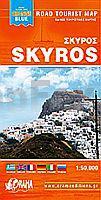
 | Skyros Touristische Landkarte - Straßenkarte - Griechische Inseln 1:50.000 Σκύρος - Skyros - Mini Map `Orange Blue` Orama - Griechenland |
 | 342-1 VILLABRAGIMA Amtliche topographische Landkarte 1:25.000 Spanien (M.T.N.) 342-1 Mapa Topográfico Nacional de Espana (MTN25) Instituto Geográfico Nacional - CNIG Spanien |
 | L4302 Kleve (geplottete Ausgabe) Amtliche topographische Karte 1:50.000 Landesvermessungsamt Nordrhein-Westfalen |
 | 475-1 LUMBRALES Amtliche topographische Landkarte 1:25.000 Spanien (M.T.N.) 475-1 Mapa Topográfico Nacional de Espana (MTN25) Instituto Geográfico Nacional - CNIG Spanien |
 | 643-4 PORT DE SA CALOBRA Amtliche topographische Landkarte 1:25.000 Spanien (M.T.N.) 643-4 Mapa Topográfico Nacional de Espana (MTN25) Instituto Geográfico Nacional - CNIG Spanien |
 | 756-2 FUENLABRADA DE LOS MONTE Amtliche topographische Landkarte 1:25.000 Spanien (M.T.N.) 756-2 Mapa Topográfico Nacional de Espana (MTN25) Instituto Geográfico Nacional - CNIG Spanien |
| 3253 Fürstenfelde Topographische Karte 1:25.000 Messtischblatt des Deutschen Reiches - Preußische Landesaufnahme / Reichsamt für Landesaufnahme - Faksimile ProjektNord |
 | L4704 Krefeld (geplottete Ausgabe) Amtliche topographische Karte 1:50.000 Landesvermessungsamt Nordrhein-Westfalen |
 | L4908 Solingen (geplottete Ausgabe) Amtliche topographische Karte 1:50.000 Landesvermessungsamt Nordrhein-Westfalen |
 | 621-3 BRAMA Amtliche topographische Landkarte 1:25.000 Spanien (M.T.N.) 621-3 Mapa Topográfico Nacional de Espana (MTN25) Instituto Geográfico Nacional - CNIG Spanien |
 | L4902 Heinsberg (geplottete Ausgabe) Amtliche topographische Karte 1:50.000 Landesvermessungsamt Nordrhein-Westfalen |
 | L4714 Arnsberg (geplottete Ausgabe) Amtliche topographische Karte 1:50.000 Landesvermessungsamt Nordrhein-Westfalen |
 | L4702 Nettetal (geplottete Ausgabe) Amtliche topographische Karte 1:50.000 Landesvermessungsamt Nordrhein-Westfalen |
 | Gurkenradweg Spreewald Leporello Radtourenkarte mit Ausflugszielen, Einkehr- & Freizeittipps, wetterfest, reissfest, abwischbar, GPS-genau. 1:50000 - von - Freytag-Berndt und ARTARIA Publicpress |