| << Cookinseln - Tokelau-Inseln - Niue - Kermadecinseln |
||
|
||
Zuletzt angesehene Artikel:
 | PI06 Nassau (Cookinseln) Topographische Landkarte 1:25.000 - Land Information New Zealand |
 | PI19 Mauke (Cookinseln) Topographische Landkarte 1:25.000 - Land Information New Zealand |
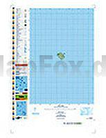
 | PI10 Manihiki (Cookinseln) Topographische Landkarte 1:25.000 - Land Information New Zealand |
 | Neumark - südlicher Teil und nördliches Niederschlesien - 1:100.000 Ausflugskarte - Ortsnamenkarte von Dirk Bloch - BLOCHPLAN |
 | PI08 Suwarrow (Cookinseln) Topographische Landkarte 1:50.000 - Land Information New Zealand |
 | 3243OT PERTUIS / LOURMARIN Topographische Wanderkarte Frankreich 1:25.000 TOP 25 IGN |
 | Plock plus 2 / Wloclawek plus 2 - Stadtplan 1:18 000 (Kutno, Wloclawek) - DEMART - Polen |
 | 1212 AMSTEG 1:25.000 - Bristen - Oberalpstock . Sedrun - Topographische Landeskarte der Schweiz - swisstopo |
 | PI09 Rakahanga (Cookinseln) Topographische Landkarte 1:25.000 - Land Information New Zealand |
 | 1112 STAFA 1:25.000 Topographische Landeskarte der Schweiz - swisstopo |
 | Adlergebirge (Blatt 9) Topographische Wanderkarte und Fahrradkarte 1:25.000 Orlické hory - Deštné - Mladkov - Pastviny - Olešnice - Rokytnice - Říčky - Skulina - Zdobnice Geodezie On Line - Tschechien |
 | 44 PASSO DEL MALOJA 1:100.000 Topographische Landeskarte der Schweiz - swisstopo |
 | 3244ET MONTAGNE SAINTE-VICTOIRE Topographische Wanderkarte Frankreich 1:25.000 TOP 25 IGN |
 | 3232 Beetzendorf Topographische Karte 1:25.000 Landesamt für Vermessung und Geoinformation Sachsen-Anhalt (Landesvermessungsamt) |
 | Troodos Region - Hiking Map Cyprus Agios Demetrios - Amiantos - Foini - Karvounas - Kato Platres - Lemithou - Mandria - Moniatis - Palaiomylos - Pano Platres - Pedoulas - Pera Pedi - Prodromos - Troodos - Wanderkarte 1:25.000, GPS-genau - Kartographos |
 | PI16 Penrhyn (Cookinseln) Topographische Landkarte 1:50.000 - Land Information New Zealand |
 | 39 FLUELAPASS 1:100.000 - Arosa - Davos - Zernez - Scuol - Topographische Landeskarte der Schweiz - swisstopo |
 | Süd-Masuren - 1:100.000 Olsztyn (Allenstein), Mikolajki (Nikolaiken), Szczytno (Ortelsburg), Pisz (Johannisburg), Orzysz (Arys), Jez. Sniardwy (Spirdingsee) - Ortsnamenkarte von Dirk Bloch - BLOCHPLAN |
| 344.12 Amtliche topographische Karte 1:25.000 Polen |
 | Fürstenberg - Feldberg - Templin (wasserfest) Kartenset 3 Rad-, Wander- und Gewässerkarten 1:35.000 (Feldberger Seen / Fürstenberg - Havel - Lychen - Templin) - Grünes Herz |