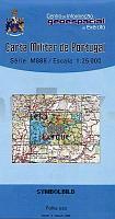
| << Portugal: Amtliche topografische Landkarten des Instituto Geográfico do Exército (IGeoE) 1:25.000 (Serie M888) |
||
|
||

Zuletzt angesehene Artikel:
 | 40 Viana do Castelo - Topographische Landkarte Portugal 1:25.000 Carta Militar de Portugal - Série M888 Instituto Geográfico do Exército (IGeoE) - Portugal |
 | U434 Sodankylä Topographische Karte 1:50.000 EUREF-FIN (Maastokarttat) Maanmittauslaitos / Lantmäteriverket Finnland - ProjektNord |
 | Gorgany Ost 1:50.000 Topografische Wanderkarte 1:50.000 Karpaten - Ukraine Eastern Gorgany / Shidny Gorgany / Східні Горгани - paperova karta Karpatski Steszky Hutyriak - Ukraine |
 | LA RUTA DE LES MIL ALCASSABES Kultur-Landkarte Süd-Marokko 1:400.000 (katalanische Ausgabe) - Editorial Editorial Piolet |
 | Nationalpark Ojców 1:20.000 Miniausgabe Touristische Wanderkarte - Laminierte Ausgabe Ojcowski Park Narodowy mini Compass - Polen |
 | V4314 Topographische Karte 1:25.000 EUREF (Peruskartta) Maanmittauslaitos / Lantmäteriverket Finnland - ProjektNord |
 | V5223 Kurupää Topographische Karte 1:25.000 EUREF (Peruskartta) Maanmittauslaitos / Lantmäteriverket Finnland - ProjektNord |
 | V4442 Topographische Karte 1:25.000 EUREF (Peruskartta) Maanmittauslaitos / Lantmäteriverket Finnland - ProjektNord |
 | Baedeker Reiseführer Malta, Gozo, Comino MAIRDUMONT |
 | 15 Velas (S. Jorge - Azoren) - Topografische Karte Portugal 1:25.000 Carta Militar de Portugal - Série M889 - 1/25 000 (Acores) - Instituto Geográfico do Exército (IGeoE) - Portugal |
 | V4222 Topographische Karte 1:25.000 EUREF (Peruskartta) Maanmittauslaitos / Lantmäteriverket Finnland - ProjektNord |
 | N4142 Haapamäki Topographische Karte 1:25.000 EUREF (Peruskartta) Maanmittauslaitos / Lantmäteriverket Finnland - ProjektNord |
 | Vosges méridionales à pied - Réf. P881 Topographischer Wanderführer - FFRP (Fédération française de randonnée pédestre) Frankreich |
 | 65 Böhmerwald - Schachtelei und Nationalpark Bayerischer Wald - Wanderkarte Tschechien 1:50.000 - KCT - Papierausgabe 65 Sumava - Povydri a Narodni Park Bavorsky les |
 | 7626 Ulm Südost Topographische Landkarte Bayern 1:25.000 - Normalausgabe - ProjektNord (geplottete Ausgabe) - Grundlage amtliche Topographische Karte Bayern DTK25 |
 | Q5441 Kalliojoki Topographische Karte 1:25.000 EUREF (Peruskartta) Maanmittauslaitos / Lantmäteriverket Finnland - ProjektNord |
 | 2228 (NL 32-03-28) Neustift im Stubaital Topographische Wanderkarte 1:50.000 mit Wegmarkierungen - Ãsterreich - Kartographie BEV - ProjektNord |
 | 10181 Repparfjorden Topographische Landkarte 1:50.000 Norge-serien - Nordeca Norwegen |
 | V4311 Köngäs Topographische Karte 1:25.000 EUREF (Peruskartta) Maanmittauslaitos / Lantmäteriverket Finnland - ProjektNord |
 | 53-534 Riedlingen - Zwiefalten 1:25.000 - Wanderkarte mit Radwegen - NaturNavi |