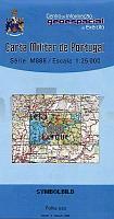
| << Portugal: Amtliche topografische Landkarten des Instituto Geográfico do Exército (IGeoE) 1:25.000 (Serie M888) |
  | |
|
||
Zuletzt angesehene Artikel:
![]() | 40 Viana do Castelo - Topographische Landkarte Portugal 1:25.000 Carta Militar de Portugal - Série M888 Instituto Geográfico do Exército (IGeoE) - Portugal |
![]() | 1019 Tondern - Gestern und Heute - Historische Überlagerung 1902-1930 Topographische Landkarte 1:25.000 im Vergleich - Landesvermessungsamt Schleswig-Holstein / ProjektNord |
![]() | 2220 (NL 32-03-20) Häselgehr Topographische Wanderkarte 1:50.000 mit Wegmarkierungen - Österreich - Kartographie BEV - ProjektNord |
![]() | 44-555 Wiesbaden und Umgebung 1:25.000 - Wanderkarte mit Radwegen, Eltville am Rhein, Eppstein, Glashütten, Idstein, Niedernhausen, Taunusstein, Walluf - NaturNavi |
![]() | Falk Stadtplan Extra Standardfaltung Bielefeld Mit Ortsteilen von Schloß Holte-Stukenbrock, Steinhagen, Werther (Westfalen) |
![]() | 19 IV Cantanhede Topographische Landkarte Portugal 1:50.000 Carta Militar de Portugal Instituto Geográfico do Exército (IGeoE) - Portugal |
![]() | 2224 (NL 32-03-24) Schwaz Topographische Wanderkarte 1:50.000 mit Wegmarkierungen - Österreich - Kartographie BEV - ProjektNord |
![]() | 1224 Sörup - Gestern und Heute - Historische Überlagerung 1902-1930 Topographische Landkarte 1:25.000 im Vergleich - Landesvermessungsamt Schleswig-Holstein / ProjektNord |
![]() | 110 Medina de Pomar Amtliche topographische Landkarte 1:50.000 Spanien (M.T.N.) 110 Mapa Topográfico Nacional de Espana (MTN50) Instituto Geográfico Nacional - CNIG Spanien |
![]() | 435-3 MEDINACELI Amtliche topographische Landkarte 1:25.000 Spanien (M.T.N.) 435-3 Mapa Topográfico Nacional de Espana (MTN25) Instituto Geográfico Nacional - CNIG Spanien |
![]() | 265 Madeira (Oleiros) - Topographische Landkarte Portugal 1:25.000 Carta Militar de Portugal - Série M888 Instituto Geográfico do Exército (IGeoE) - Portugal |
![]() | 128 Joao da Pesqueira - Topographische Landkarte Portugal 1:25.000 Carta Militar de Portugal - Série M888 Instituto Geográfico do Exército (IGeoE) - Portugal |
![]() | 2225 Quickborn - Gestern und Heute - Historische Überlagerung 1902-1930 Topographische Landkarte 1:25.000 im Vergleich - Landesvermessungsamt Schleswig-Holstein / ProjektNord |
![]() | BACHER Straßenkarte Deutschland 1:700.000 Wandkarte - beidseitig kaschiert / foliert, mit Alu-Plakatleisten - Format: 98 x 129 cm Bacher-Verlag |
![]() | 23 I Figueiro dos Vinhos - Topographische Landkarte Portugal 1:50.000 Carta Militar de Portugal Instituto Geográfico do Exército (IGeoE) - Portugal |
![]() | 2021 Burg (Dithmarschen) - Gestern und Heute - Historische Überlagerung 1902-1930 Topographische Landkarte 1:25.000 im Vergleich - Landesvermessungsamt Schleswig-Holstein / ProjektNord |
![]() | 1 Melgaço - Topographische Landkarte Portugal 1:25.000 Carta Militar de Portugal - Série M888 Instituto Geográfico do Exército (IGeoE) - Portugal |
![]() | 1124 Westerholz - Gestern und Heute - Historische Überlagerung 1902-1930 Topographische Landkarte 1:25.000 im Vergleich - Landesvermessungsamt Schleswig-Holstein / ProjektNord |
![]() | 568 Odeceixe (Aljezur) Topographische Landkarte Portugal 1:25.000 Carta Militar de Portugal - Série M888 Instituto Geográfico do Exército (IGeoE) - Portugal |


