(Titelbild evtl. abweichend)
 MÄNGELEXEMPLAR - Altauflage 2018 + leicht beschädigt, daher zum Sonderpreis. Topographische Wanderkarte für die Gegend um Regensburg-Süd mit Wanderwegen und Radwanderwegen. Für Touristik und Freizeit bietet die ATK25 in Verbindung mit einer plastischen Geländeschummerung das aktuelle Netz der Wanderwege (Rot) und Radwege (Grün). Einzelne touristische Hinweise und Symbole ergänzen die Kartendarstellung. Das eingetragene UTM-Kilometergitter gewährleistet dem GPS-Nutzer Koordinatensicherheit. Gegenüber den Rahmenblättern (herkömmliche Blätter im Regelblattschnitt) 1:25.000 stellt ein ATK25-Kartenblatt eine 3,5-fach größere Kartenfläche dar. Die einzelnen Karten haben zu Ihren Nachbarblättern einen 4 km breiten Überlappungsbereich.  Kartenbeispiel aus der Serie Kartenbeispiel aus der Serie
Blattübersicht (externer Link) Klicken Sie hier, wenn Sie diesen Artikel in der Version zum normalen Preis sehen möchten. Kartenausschnitt
|
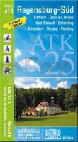
J13 Regensburg-Süd - Kelheim - Bad Abbach - Nittendorf - Schierling - Saal a.d.Donau - Sinzing *** SCHNÄPPCHEN *** ATK25 Topographische Karte 1:25.000 (Atkis) Bayern Landesvermessungsamt Bayern - Wanderkarte
EAN / ISBN: 9783899339857
Preis: EUR 4.50
|
| 


