(Titelbild evtl. abweichend)
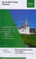 Mängelexemplar. Altauflage 2007, daher zum Sonderpreis. Amtliche topographische Karte Österreich mit Wegmarkierungen der Wanderwege vom BEV (Bundesamt für Eich- und Vermessungswesen).  Kartenbeispiel aus der Serie Kartenbeispiel aus der Serie
Blattschnitte (West) Blattschnitte (Mitte) Blattschnitte (Ost) HINWEIS: Der Preis setzt sich zusammen aus Landenpreis 9,90 EUR + Pauschale wegen hoher Beschaffungskosten: 1 EUR Klicken Sie hier, wenn Sie diesen Artikel in der Version zum normalen Preis sehen möchten. Kartenausschnitt
|
NL 33-05-01 West (4101-West) Flattnitz *** SCHNÄPPCHEN *** Österreichische Karte 1:25.000 mit Wegmarkierungen (topographische Wanderkarte - UTM) - BEV - Österreich - Vergrößerung (ÖK25V)
EAN / ISBN: 9007868056447
Preis: EUR 5.00
|
| 


