Willkommen bei MapFox
Wurde Ihre Bestellung bestätigt? Wenn nicht - gab es evtl. ein SERVER-Problem! Bitte kontaktieren Sie uns! +++ Buchhändler-Anfragen erwünscht +++
Warenkorb
Artikel: 0 - € 0.00
Zur Kasse
Widerruf Impressum Kontakt Versandkosten AGB
Cotswolds Reisekarte 1:126.720 map & guide for places to visit - Goldeneye mapguides (engl.)
Cotswolds touring mapguide Goldeneye Publications - Großbritannien
<< Großbritannien
<< Goldeneye Publications - Großbritannien
 
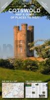
Cover

It is the simple combination of the Map and the Guide that makes exploring the Cotswolds such a pleasure.

? Where to Go, What to See, What to Do... and Where to Eat & Drink...
? The ideal publication for a short break, a long weekend, or your first-ever visit to the Cotswolds...
? Save time and money by choosing this practical combination of a Leisure Map, backed up by a Travel Guide with 5 Scenic Drives (car tours) described and highlighted on the Map

The Leisure Map
? The ideal scale for touring @ 1:126,720 (2 miles to 1 inch)
? Tourist Attractions/Inns With Rooms/Hotels are illustrated
? Altitude Layering indicates the topography
? 5 Scenic Drives (Car tours) overprinted
? Clear and easy-to-follow...easy to fold and unfold

The Travel Guide
? Opening Times to Attractions: gardens, country houses, art galleries
? Foodie pubs and tearooms selected on merit
? Lavishly illustrated with colour photographs
? 3 Scenic Drives (car tours) described
? So easy to plan your day, your week...your holiday

The Ideal Companion for exploring the Cotswolds scenic villages, ?Wool’ towns, river valleys and, atypical English landscape.

Kartenausschnitt

Kartenbeispiel

Cotswolds Reisekarte 1:126.720 map & guide for places to visit - Goldeneye mapguides (engl.)
Cotswolds touring mapguide Goldeneye Publications - Großbritannien
EAN / ISBN: 9781859653197
Preis: EUR 15.90

Bestellartikel: versandfertig in ca. 3-7 Tagen. Dieser Artikel wird speziell für Sie bestellt. Keine Rücknahme!
Produkt EUR Anzahl Bestellen
Cotswolds Reisekarte 1:126.720 map & guide for places to visit - Goldeneye mapguides (engl.)
Cotswolds touring mapguide Goldeneye Publications - Großbritannien
15.90
Versandkostenfrei in Deutschland ab 30,- Bestellwert

incl. MwSt.

Stichworte, die bei der Suche nützlich sein könnten:
Cotswolds Landkarte - Goldeneye Publications - Großbritannien Wanderkarten - Großbritannien Landkarten - Großbritannien Wanderführer - Großbritannien Reiseführer - Großbritannien - UK - United Kingdom - England - Großbritannien - UK Landkarten - England - Schottland - Wales - Nordirland - Vereinigtes Königreich - Großbritannien Karten - Großbritannien Landkarten - Großbritannien Fahrradkarten - Großbritannien Kartographie - Großbritannien Kartografie - Großbritannien Landkartenverkauf - Großbritannien Wanderkarten - Großbritannien Straßenkarten - Großbritannien Radwanderführer - Großbritannienkarten - Großbritannien Reiseführer - Großbritannien Radwanderkarten - Großbritannien Atlanten

Zuletzt angesehene Artikel:

CoverCotswolds Reisekarte 1:126.720 map & guide for places to visit - Goldeneye mapguides (engl.)
Cotswolds touring mapguide Goldeneye Publications - Großbritannien

Cover04 Bad Tölz - Lenggries - Isarwinkel 1:35.000 Outdoorkarte - Wanderkarte Jachenau, Kochel, Walchensee - Kümmerly & Frey

CoverGrande Traversata delle Alpi (Teil 2) 1:25.000 *** SCHNÄPPCHEN *** Dal Santuario di Oropa al Rifugio Quintino Sella al Monviso - Geo4 Map - Italien

CoverKorsika 1:200.000 - Straßenkarte Frankreich
Corsica Libreria Geografica

CoverStraßenkarte Portugal 1:100.000 (individueller Ausschnitt) Topographische Landkarte - ProjektNord

Cover20 Giurgeu- und Hasmas-Gebirge Wanderkarte Rumänien 1:60.000 *** SCHNÄPPCHEN ***
Muntii Giurgeu si Hasmas Dimap

CoverWesterwald - Kroppacher Schweiz Topographische Wanderkarte Rheinland-Pfalz mit Wanderwegen und Radwegen 1:25.000 - ProjektNord

Cover140 Quantock Hills & Bridgwater - Wanderkarte Großbritannien 1:25.000 *** SCHNÄPPCHEN *** EXPLORER MAP - Ordnance Survey

CoverBreslau Stadtplan 1:20.000 Laminierter Stadtplan
Wrocław laminowany plan miasta Demart - Polen

CoverOberschlesisches Industrierevier - 1:100.000 Ortsnamenkarte von Dirk Bloch - BLOCHPLAN

CoverLettland Straßenkarte 1:500.000
Latvija Autocelu Karte - Latvia road map Jana Seta

CoverA Pilgrim`s Guide to the Camino Portugués Lisboa - Porto - Santiago - by John Brierley Caminoguides - Findhorn Press

CoverWilster Marsch Topographische Wanderkarte mit Wanderwegen und Radwegen 1:40.000 Schleswig-Holstein - ProjektNord

CoverArctic Ice Climbing - 93 ice routes from Møysalen to Bardu (englisch) von Christian Dramsdahl - Fri Flyt AS Norwegen

CoverPolen - Straßenatlas (Format ca. A5, verdeckte Spiralbindung) 1:500.000 - mit 20 Innenstadtplänen -Kompas - Carta Blanca (Polen)

CoverNationalpark Eifel - Rureifel - Hohes Venn 1:50.000 *** SCHNÄPPCHEN *** Wanderkarte und Freizeitkarte - GeoMap

CoverKanarische Inseln 1:130.000 *** SCHNÄPPCHEN *** Landkarte - ITMB International Travel Maps (engl.)
Canary Islands

CoverRegione Autonomia Friuli - Venezia - Giulia 1:100.000 mit Registerheft Topografische Straßenkarte - Casa Editrice Tabacco - Italien

CoverCamino Primitivo: Oviedo to Santiago on Spains Original Way - Pilgerführer Jakobsweg (englisch) MapGuide - Village to Village Press

CoverJakobsweg Schweiz Bd. 3 Einsiedeln - Brünigpass Innerschweizweg Werd Verlag Schweiz
