Willkommen bei MapFox
Wurde Ihre Bestellung bestätigt? Wenn nicht - gab es evtl. ein SERVER-Problem! Bitte kontaktieren Sie uns! +++ Buchhändler-Anfragen erwünscht +++
Warenkorb
Artikel: 0 - € 0.00
Zur Kasse
Widerruf Impressum Kontakt Versandkosten AGB
Arctic Ice Climbing - 93 ice routes from Møysalen to Bardu (englisch) von Christian Dramsdahl - Fri Flyt AS Norwegen
<< Norwegen: Wanderführer - Radwanderführer - Reiseführer - Kletterführer
<< Fri Flyt - Tourenführer Norwegen
 
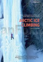
Cover

Henrikafossen, Spansdalen, Møysalen, or the famous 700m long Skredbekken are among the highlights luring climbers from all over the world to the magical scenery north of the arctic circle.

Ice climbing in Harstad and the adjoining regions is something completely different from what you could be used to at more crowded places. Most ice lines have little or no signs of being climbed before you you`re usually not putting your axe in any pre set "chopping blocks", and there’s no queue. The season for ice climbing is long, the ice usually reliable. Arctic Ice Climbing is a new frontier with world class lines waiting to be discovered by you.

Arctic ice climbing consists of 93 different routes, spanning 8 areas from Møysalen up to Bardu through Sweden and a lot more. It`s written entirely in english over 227 pages . The book covers the areas of Bardu, Lavangen Salangen, Riksgränsen / Abisko, Gratangen, Evenes Skånland, Harstad, Tjeldsund and Møysalen national park.

The book is written to comply with the genre defying standards set by Fri Flyt publishing. All routes are graded by WI (and M where applicable) and range from WI2 to WI6. Every route is marked, graded and presented with alternative routes or descents where applicable. In addition, the book includes a chapter on safety in ice climbing and a seperate section on natural risks and avalanche safety.

The author Christian Dramsdahl has also written Toppturer rundt Harstad, about ski touring in the Harstad area . He has been skiing and climbing in the region for decades.

Kartenausschnitt

Kartenbeispiel

Arctic Ice Climbing - 93 ice routes from Møysalen to Bardu (englisch) von Christian Dramsdahl - Fri Flyt AS Norwegen
EAN / ISBN: 9788293090809
Preis: EUR 67.00

Bestellartikel: versandfertig in ca. 3-7 Tagen. Dieser Artikel wird speziell für Sie bestellt. Keine Rücknahme!
Produkt EUR Anzahl Bestellen
Arctic Ice Climbing - 93 ice routes from Møysalen to Bardu (englisch) von Christian Dramsdahl - Fri Flyt AS Norwegen 67.00
Versandkostenfrei in Deutschland

incl. MwSt.

Stichworte, die bei der Suche nützlich sein könnten:
Eisklettern Norwegen - Norwegen Wanderführer - Norwegen Radwanderführer - Norwegen Reiseführer - Norwegische Fernradwege - Norwegen Fernradwege - Norwegen Kletterführer - Skiführer Skandinavien - Wanderführer Norwegen - Norwegische Wanderführer - Toppturer - Toppturar

Zuletzt angesehene Artikel:

CoverArctic Ice Climbing - 93 ice routes from Møysalen to Bardu (englisch) von Christian Dramsdahl - Fri Flyt AS Norwegen

CoverPolen - Straßenatlas (Format ca. A5, verdeckte Spiralbindung) 1:500.000 - mit 20 Innenstadtplänen -Kompas - Carta Blanca (Polen)

CoverNationalpark Eifel - Rureifel - Hohes Venn 1:50.000 *** SCHNÄPPCHEN *** Wanderkarte und Freizeitkarte - GeoMap

CoverKanarische Inseln 1:130.000 *** SCHNÄPPCHEN *** Landkarte - ITMB International Travel Maps (engl.)
Canary Islands

CoverRegione Autonomia Friuli - Venezia - Giulia 1:100.000 mit Registerheft Topografische Straßenkarte - Casa Editrice Tabacco - Italien

CoverCamino Primitivo: Oviedo to Santiago on Spains Original Way - Pilgerführer Jakobsweg (englisch) MapGuide - Village to Village Press

CoverJakobsweg Schweiz Bd. 3 Einsiedeln - Brünigpass Innerschweizweg Werd Verlag Schweiz

CoverIsland Straßenatlas 1:300.000 Spiral
Island - Kortabok Mál og menning

CoverIl Cammino di Santiago de Compostela Teil 1 - 1:50.000 - da Saint-Jean-de-Port a León - Wanderkartenatlas - Geo4 Map - Italien

CoverMulde - Wurzen (Blatt 03) Topographische Wanderkarte 1:25.000 mit Wanderwegen - ProjektNord

CoverUngarn 1:400.000 Auto- + Freizeitkarte
Magyarorszag - Hongarije - Hungary - Hongrie - Ungheria freytag & berndt

CoverTop End and Gulf 1:2 Mio. - *** SCHNÄPPCHEN *** Regionale Straßenkarte Australien - HEMA Maps

Cover2 España norte Landkarte 1:500.000 Straßenkarte Spanien - CNIG Centro Nacional de Información Geográfico

CoverIsland Nordwest Straßenkarte Generalkarte 1:300.000
Island Mál og menning

Cover36 Böhmerwald - Lippener Stausee - Krumau Wanderkarte Tschechien 1:50.000
Sumava - Lipensko, Ceský Krumlov - SHOCart

CoverIsola d`Elba 1:25.000 - Wanderkarte (Blatt 901) - Topographische Wanderkarte Geo4 Map - Italien
Carta escursionistica Isola d`Elba

CoverJakobsweg Schweiz Bd.6 Romont - Geneve Weg der Romandie Werd Verlag Schweiz

CoverZeven Topographische Wanderkarte mit Wanderwegen und Radwegen 1:25.000 Niedersachsen - ProjektNord

CoverManhattan 1:12.000 & New York State 1:800.000 (wasserfest) *** SCHNÄPPCHEN *** Stadtplan - ITMB International Travel Maps

CoverPolen Straßenatlas Marco Polo 1:300.000
Polska - Atlas Drogowy Marco Polo Polen
