Willkommen bei MapFox
Wurde Ihre Bestellung bestätigt? Wenn nicht - gab es evtl. ein SERVER-Problem! Bitte kontaktieren Sie uns! +++ Buchhändler-Anfragen erwünscht +++
Warenkorb
Artikel: 0 - € 0.00
Zur Kasse
Impressum Kontakt Versandkosten AGB
Ridges of Snowdonia - The best ridge walking in Snowdonia Wanderführer - Cicerone Großbritannien (englisch)
<< Großbritannien: Wanderführer + Kletterführer
<< Cicerone
 
Cover

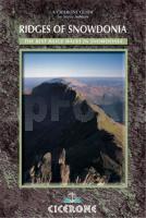
his handy guidebook describes the best ridge walking to be found in Snowdonia

Ridge walking

The term is applied loosely throughout the guidebook. In addition to following a narrow crest, a ridge walk may also be said to follow the high ground between summits, however broad it may be.

Scrambling

Sections of some of these routes follow narrow exposed ridges involving rock scrambling where hands are used to assist the ascent. While even the most awkward of those included here should be within the capability of seasoned walkers, it is worth remembering that adverse conditions of any kind may dramatically increase their difficulty.

Ridge walking in winter

These routes - without exception - are severely affected by winter weather and its ground conditions, making great demands on winter skills and navigating ability. An ice-axe is essential (so are crampons - even if these are held in reserve); but so too is the stamina and experience to cope with what can suddenly develop into a very serious expedition. Some of the scrambling routes - Snowdon Horseshoe and Bristly Ridge among them - can be totally transformed by winter conditions, becoming potential winter climbs of some difficulty.

Kartenausschnitt

Ridges of Snowdonia - The best ridge walking in Snowdonia Wanderführer - Cicerone Großbritannien (englisch)
EAN / ISBN: 9781852843502
Preis: EUR 18.90

Titel war vor einiger Zeit nicht lieferbar. Bitte ggf. Lieferbarkeit erfragen.
Produkt EUR Anzahl Bestellen
Ridges of Snowdonia - The best ridge walking in Snowdonia Wanderführer - Cicerone Großbritannien (englisch) 18.90
Versandkostenfrei in Deutschland ab 30,- Bestellwert

incl. MwSt.

Stichworte, die bei der Suche nützlich sein könnten:
Snowdonia-Nationalpark - Adlerhorst - Snowdonia - Cicerone - Cicerone Radwanderführer - Cicerone Wanderführer - Großbritannien Radwanderführer - Großbritannien Wanderführer - Cicerone Großbritannien - Großbritannien - Großbritannien Wanderführer - Großbritannien Trekkingführer - Großbritannien Klettern - Großbritannien Kletterführer

Zuletzt angesehene Artikel:

CoverRidges of Snowdonia - The best ridge walking in Snowdonia Wanderführer - Cicerone Großbritannien (englisch)

CoverRadwanderkarte Naturschatzkammern Allgäu RW-NSKA Bad Wurzach - Isny im Allgäu - Leutkirch im Allgäu - Wangen im Allgäu - Württembergisches Allgäu - Esterbauer Verlag

Noch kein Cover vorhandenRunning Challenges in England, Scotland & Wales Vertebrate Publishing

Cover60a Rheingau - Lorch - Rüdesheim - Wiesbaden 1:25.000 Wanderkarte mit Rettungspunkten Rundwanderwege mit Beschreibung auf der Rückseite GW Rheingau-Taunus-Kartographie

CoverDie schönsten Wanderwege im Rhein-Mosel-Gebiet - von Hans-Joachim Schneider - J.P. Bachem Verlag

CoverSigdal og Rollag Wanderkarte Norwegen 1:50.000 (Blatt 2571) - Nordeca / UGLAND / Statens Kartverk Norwegen

CoverRadwanderführer Nord-Ostsee-Radweg / Grenzroute Radwanderführer - von Landeck, Horst-Dieter - Boyens Buchverlag

CoverCykelkartan Blad 7 Sydvästra Småland Fahrradkarte Schweden 1:90.000 - Norstedts

Cover20 Overijssel west - Fahrradkarte 1:66.666 Overijssel west fietskaart
Overijssel west - ANWB fietskaart 20 - ANWB - Niederlande

CoverRazna Nationalpark Sonderkarte 1:100.000 mit Stadtplänen
Rāznas nacionālais parks - Jana Seta - Landkarte Lettland

CoverGera - Ronneburg - Bundesgartenschau 2007 (Blatt 11) Topographische Wanderkarte Thüringen 1:25.000 - Thüringer Landesvermessungsamt - Wanderkarte mit Wanderwegen

CoverRio de Janeiro 1:15.000 Stadtplan City Destination Map National Geographic

Cover6425 Röttingen Topographische Landkarte Bayern 1:25.000 - Normalausgabe - ProjektNord (geplottete Ausgabe) - Grundlage amtliche Topographische Karte Bayern DTK25

CoverRuunaa 1:30.000 Wanderkarte Finnland

CoverReggio nell` Emilia Provinzialautokarte - Straßenkarte 1:150.000 - Italien
Reggio nell` Emilia - Carta stradale della Provincia - Italia L.A.C. GlobalMap Italien

CoverReinhardswald Nord Topographische Wanderkarte mit Wanderwegen 1:25.000 - ProjektNord

CoverSchwerte - Ruhr-Höhenweg Topographische Wanderkarte Nordrhein-Westfalen mit Wanderwegen und Radwegen 1:25.000 - ProjektNord

CoverRuhrgebiet Radkarte mit Ausflugszielen, Einkehr- & Freizeittipps, wetterfest, reissfest, abwischbar, GPS-genau. 1:100000 - von - Freytag-Berndt und ARTARIA Publicpress

CoverRadregion Wasserradlwege Oberbayern Drei Rundtouren zwischen Donau, Inn und Alpen - Hopfenschleife, Salzschleife, Kunstschleife, 1:50.000, 1.310 km, wetterfest - von Esterbauer Verlag

CoverTraumtouren E-Bike & Bike Band 4 Ein schöner Tag - 15 Sonntagstouren mit E-Bike & Bike. Band 4: Bergisches Land, Sauerland, Ruhrgebiet - von Schönhöfer, HartmutSchöllkopf, Uwe - Idee-Media