Willkommen bei MapFox
Wurde Ihre Bestellung bestätigt? Wenn nicht - gab es evtl. ein SERVER-Problem! Bitte kontaktieren Sie uns! +++ Buchhändler-Anfragen erwünscht +++
Warenkorb
Artikel: 0 - € 0.00
Zur Kasse
Impressum Kontakt Versandkosten AGB
Todra Rock climbing in the Todra Gorge by Geoff Hornby - Kletterführer (englisch) Oxford Alpine Club
<< Marokko
<< Oxford Alpine Club - OAC
 
Cover

Lying on the southern fringe of the High Atlas Mountains is one of Morocco`s premier climbing destinations - the magnificent Todra Gorge. Here, bathed in year-round sunshine, you will find a climbing experience like few others: an enticing blend of sport, adventure and exotic culture...

The gorge is home to over 450 recorded routes, and whilst most of them are fully bolted sport climbs there are also some long, adventurous traditionally protected routes on stunning vertical walls. Sunshine and shade is available throughout the year, making this one of the few places in Morocco where it is possible to climb year-round, whether you`re looking for single pitch, low-commitment sport cragging, or 10-pitch bolted adventures.

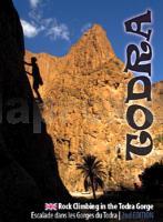
This latest edition is the most comprehensive and up-to-date topo currently available for this exotic climbing destination, featuring photo topos for 39 of Todra`s most famous and popular climbing sectors, alongside detailed maps and background information.

Kartenbeispiel

Todra Rock climbing in the Todra Gorge by Geoff Hornby - Kletterführer (englisch) Oxford Alpine Club
EAN / ISBN: 9781913167141
Preis: EUR 34.90

Bestellartikel: versandfertig in ca. 2 Wochen oder länger. Dieser Artikel wird speziell für Sie bestellt. Keine Rücknahme!
Produkt EUR Anzahl Bestellen
Todra Rock climbing in the Todra Gorge by Geoff Hornby - Kletterführer (englisch) Oxford Alpine Club 34.90
Versandkostenfrei in Deutschland

incl. MwSt.

Stichworte, die bei der Suche nützlich sein könnten:
Gorges du Todra - Todgha - Todraschlucht Kletterführer - Atlasgebirge - Gorges du Todgha - Marokko Kletterführer - Oxford Alpine Club - Marokko - Marokko Straßenkarten - Marokko Atlanten - Marokko Wanderkarten - Marokko Karten - Marokko Fahrradkarten - Marokkokarten - Marokko Kartografie - Marokko Radwanderführer - Marokko Kartographie - Marokko Radwanderkarten - Marokko Reiseführer - Marokko Landkarten - Marokko Landkartenverkauf - Morocco - Morocco maps - Marokko Kletterkarten - Marokko Kletterführer - Anti-Atlas Gebirge - Atlasgebirge

Zuletzt angesehene Artikel:

CoverTodra Rock climbing in the Todra Gorge by Geoff Hornby - Kletterführer (englisch) Oxford Alpine Club

CoverYorkshire Dales Cycle Way Radwanderkarte 1:100.000 Cycle Route NY10 - HARVEY MAPS
Yorkshire Dales Cycle Way - Cycle Route NY10 - Cycling Map

Noch kein Cover vorhandenL-34-38-C Simontornya Amtliche Topographische Karte Ungarn 1:50.000

Cover11/7-8 KOKSIJDE NGI 1:25.000 Topographische Landkarte Belgien

Cover379 Dunkeld - Aberfeldy & Glen Almond - Wanderkarte Großbritannien 1:25.000 EXPLORER MAP - Active Map LAMINIERT - Ordnance Survey

Noch kein Cover vorhandenL-34-38-B Dunaujvaros Amtliche Topographische Karte Ungarn 1:50.000

CoverCycling in the Yorkshire Dales - 24 circular rides and a 6-day tour Radwanderführer (englisch) Cicerone Großbritannien

CoverL6318 Erbach (geplottete Ausgabe) Topographische Landkarte Hessen 1:50.000 - ProjektNord

Cover3-Länder-Radweg Eine abwechslungsreiche Tour durch den hessischen, bayerischen und badischen Odenwald 213 km - Esterbauer

Cover153 Bedford & Huntingdon - St Neots & Biggleswade - Wanderkarte Großbritannien 1:50.000 LANDRANGER MAP - Ordnance Survey

Cover085 Carlisle & Solway Firth - Gretna Green - Wanderkarte Großbritannien 1:50.000 LANDRANGER MAP - Ordnance Survey

Noch kein Cover vorhanden042 N Uvdal NORD 1:50.000 - Amtliche Topographische Landkarte Norwegen - Startens Kartverk

Noch kein Cover vorhanden2323SB ST-MARTIN-DAUXIGNY - FOËCY GPS Amtliche Topographische Wanderkarte Frankreich 1:25.000 - série bleue (IGN)

Cover010 Strathnaver - Bettyhill & Tongue - Wanderkarte Großbritannien 1:50.000 LANDRANGER MAP - Ordnance Survey

Noch kein Cover vorhandenM-34-140-C-d Amtliche Topographische Karte Ungarn 1:25.000

Cover003 Shetland - North Mainland - Wanderkarte Großbritannien 1:50.000 Active Laminiert LANDRANGER MAP - Ordnance Survey

Cover177 East London - Billericay & Gravesend - Wanderkarte Großbritannien 1:50.000 LANDRANGER MAP - Ordnance Survey

CoverVesterålen Hinnøya Nord Turkart Norwegen 1:100.000 (Blatt 2812) - Nordeca / UGLAND / Statens Kartverk Norwegen

CoverKnoydart Wanderkarte 1:25.000 (wasserfest) HARVEY MAPS
Knoydart - Superwalker map XT25 - waterproof

CoverBorriol - La Plana Alta Wanderkarte 1:15.000 El Tossal Cartographies - Valencia - Spanien
Mapa del terme municipal de Borriol