| << Deutschland: Historische Karten und Stadtpläne (im Bereich der heutigen Bundesrepublik) << Rockstuhl |
||
|
||

Zuletzt angesehene Artikel:
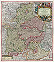
 | Bayern 1741 - Historische Landkarte Nachdruck Planokarte - gerollt von Seutter, Matthäus - Verlag Rockstuhl |
 | 276T VAL VERZASCA - Valle Maggia - Riviera 1:50.000 Topographische Wanderkarte SAW der Schweiz - swisstopo |
 | Barisakho - Roshka - Juta - Asa Gorge Trekkingkarte Georgien 1:50.000 (Blatt 3) Geoland Maps Barisakho, Roshka, Juta, Asa Gorge, 1:50.000 |
 | 287 MENAGGIO 1:50.000 -Porlezzo - Bellagio - Valsassina - Topographische Landeskarte der Schweiz - swisstopo |
 | 52 THUIN NGI 1:50.000 Topographische Karte Belgien |
 | Europa - Westeuropa - Baltische Staaten - Weißrussland - Ukraine - Moldau Autoatlas / Straßenatlas - Russland Atlas awtomobilnych dorog. Ewropa. Sapadnaja Ewropa, strany Baltii, Belarus, Ukraina, Moldowa |
 | BC32 Topographische Landkarte Neuseeland 1:50.000 Land Information New Zealand |
 | NR11 Nouvelle-Aquitaine (Bassin Aquitain) Regionalkarte / Straßenkarte Frankreich 1:250.000 - IGN |
 | NA503 Around Annapurna 1:125.000 Marsyangdi, Thorung Pass, Kali Gandaki - New Annapurna Trekking Trails updated to avoid the road - Nepa Maps Himalayan Maphouse Nepal |