| << Deutschland: Historische Karten und Stadtpläne (im Bereich der heutigen Bundesrepublik) << Rockstuhl |
||
|
||

Zuletzt angesehene Artikel:
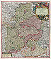
 | Bayern 1741 - Historische Landkarte Nachdruck Planokarte - gerollt von Seutter, Matthäus - Verlag Rockstuhl |
 | Schüttenhofen (Blatt 103) - Wasserfest auf Pretex Topographische Wanderkarte 1:25.000 EUROKART (tschechisch) 103 Sušicko Geodezie On Line - Tschechien |
 | L6944 Zwiesel (geplottete Ausgabe) Topographische Karte Bayern 1:50.000 Bayerisches Landesvermessungsamt |
 | Vätsäri - Kessi - Øvre Pasvik 1:50.000 Topographische Wanderkarte - Outdoor map - Genimap / Karttakeskus - Finnland |
 | Bergen - 7-Fjellsturen Wanderkarte Norwegen 1:25.000 (Blatt 2429) - Nordeca / UGLAND / Statens Kartverk Norwegen |
 | Mähren - 1592 Historische Landkarte auf Pergament (Faksimile) - 50 x 37,5 cm - PLANO gerollt Antica |
 | 7427 Sontheim a. d. Brenz Topographische Landkarte 1:25.000 - Landesvermessungsamt Baden-Württemberg |
 | Kindereuropakarte Max und Maxi entdecken Europa WANDKARTE mit Metallleisten und Aufhängeschnur 97 x 67 cm - Stiefel EUROCART |
 | Lierneux Wandelen NGI 1:50.000 - mit 34 Wanderwegen Touristische Landkarte und Wanderkarte Belgien |
 | Dänemark und Süd-Schweden 1:450.000 / 1:90.000 Landkarte - ITMB International Travel Reference Maps (engl.) Denmark and Southern Sweden ITMB International Travel Maps (engl.) |
 | Radtourführer Mährisch-Schlesische Beskiden Ausflüge auf dem Rad Cyklopruvodce Moravskoslezské Beskydy - Výlety na kole SHOCart - Tschechien |
 | Gaustatoppen - Rjukan - Tinnsjå - Veggli - Blefjell Topographische Wanderkarte Topo 3000 - 1:50.000 (Blatt 3018) - Nordeca - Norwegen |
 | 14 Halmstad 1:50.000 (wasserfest) *** SCHNÄPPCHEN *** Topographische Wanderkarte - Sverigeserien Topo50 - Schweden Norstedts |
 | 76 Falun 1:50.000 (wasserfest) *** SCHNÄPPCHEN *** Topographische Wanderkarte - Sverigeserien Topo50 - Schweden Norstedts |
 | Mountainbike fahren rund um Göteborg MTB-Führer schwedisch Mountainbike kring Göteborg Calazo Förlag Schweden |