Willkommen bei MapFox
Wurde Ihre Bestellung bestätigt? Wenn nicht - gab es evtl. ein SERVER-Problem! Bitte kontaktieren Sie uns! +++ Buchhändler-Anfragen erwünscht +++
Warenkorb
Artikel: 0 - € 0.00
Zur Kasse
Widerruf Impressum Kontakt Versandkosten AGB
WORLD-STRESS-MAP 2025 - POSTER gerollt ca. 98 x 59 cm ohne Legende und geringfügig vergrößert
<< Welt - allgemein
 
Cover

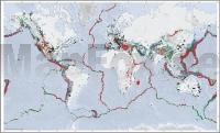
The World Stress Map (WSM) is a global compilation of information on the crustal present-day stress field maintained since 2009 at the GFZ Helmholtz Centre for Geosciences within Section 2.6 Seismic Hazard and Risk Dynamics. It is a collaborative project between academia and industry that aims to characterize the crustal stress pattern and to understand the stress sources. The WSM commenced in 1986 as a project of the International Lithosphere Program (ILP) under the leadership of Mary-Lou Zoback. From 1995-2008 it was a project of the Heidelberg Academy of Sciences and Humanities headed by Karl Fuchs and Friedemann Wenzel. . All stress information is analysed and compiled in a standardized format and quality-ranked for reliability and comparability on a global scale. The latest WSM database release 2025 contains 100,842 data records located in the Earth’s crust. The WSM is an open-access public database and is used by various academic and industrial institutions working in a wide range of Earth science disciplines such as geodynamics, hazard assessment, reservoir geomechanics, and geotechnical applications. The main operational areas are

- Reservoir characterization and management
- Stability of mines, tunnel, boreholes and waste disposal sites
- Calibration of geomechanical-numerical models
- 4D Thermo-Hydro-Mechanical (THM) modelling of stress changes
- Hazard assessment e.g. by means of fault-slip tendency and fracture potential analysis

HINWEIS: Für ein angenehmeres Endformat wurde die Legende auf der linken Seite abgeschnitten und der Rest der Karte etwas vergrößert. Bis auf die Längen und Breitengrade, Projektionsangabe und den nun nicht mehr ganz stimmigen Maßstab finden sich keine weiteren Beschriftungen auf der Karte.

Kartenbeispiel

WORLD-STRESS-MAP 2025 - POSTER gerollt ca. 98 x 59 cm ohne Legende und geringfügig vergrößert
Preis: EUR 49.90

sofort versandfertig Dieser Artikel ist im Normalfall sofort lieferbar.
Produkt EUR Anzahl Bestellen
WORLD-STRESS-MAP 2025 - POSTER gerollt ca. 98 x 59 cm ohne Legende und geringfügig vergrößert 49.90
Versandkostenfrei in Deutschland

incl. MwSt.

Stichworte, die bei der Suche nützlich sein könnten:
Plattentektonik - Kontinentalplatten - Welt Landkarte - Subduktionszonen - Weltkarte - Welt - Erde

Zuletzt angesehene Artikel:

CoverWORLD-STRESS-MAP 2025 - POSTER gerollt ca. 98 x 59 cm ohne Legende und geringfügig vergrößert

CoverAltafulla Stadtplan 1:5.000 mit Wanderkarte 1:15.000 - Editorial Piolet - Spanien

Cover166 Dax - Bayonne Topographische Touristische Landkarte Tourismus und Fahrrad (wasserfest) - tourisme et vélo plastifiée TOP100 - 1:100.000 - IGN Frankreich

CoverMoselberge - Klüsserath - Piesport Topographische Wanderkarte Rheinland-Pfalz mit Wanderwegen und Radwegen 1:25.000 - ProjektNord

CoverLonquimay - Conguillio 1:100.000 Trekkingkarte
Lonquimay - Conguillío Trekking Map Viachile Editores - Chile

CoverHAUTE-SAVOIE (Blatt D74) Département-Landkarte Frankreich 1:100.000
HAUTE-SAVOIE - Carte départementale - IGN Frankreich

Cover2843OT AIGUES-MORTES - La Grande-Motte Topographische Wanderkarte Frankreich 1:25.000 TOP 25 IGN

CoverBelle-Île - per Rad und zu Fuß Inselkarte 1:30.000 -
BELLE-ÎLE à vélo et à pied Collection Mini Cartes des Îles - IGN - Frankreich

CoverMassif du Mézenc - Gerbier-de-Jonc 1:33.333 Wanderkarte *** SCHNÄPPCHEN *** Culture & Environnement - IGN Frankreich

CoverParc Naturel Régional d`Armorique - Parc an Arvorig 1:100.000 *** SCHNÄPPCHEN *** Kultur und Natur - IGN Frankreich
