Willkommen bei MapFox
Wurde Ihre Bestellung bestätigt? Wenn nicht - gab es evtl. ein SERVER-Problem! Bitte kontaktieren Sie uns! +++ Buchhändler-Anfragen erwünscht +++
Warenkorb
Artikel: 0 - € 0.00
Zur Kasse
Impressum Kontakt Versandkosten AGB
Frankreich: Wanderkarten Pyrenäen + Alpen + Bretagne - RANDO EDITION
<< Frankreich
 

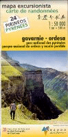
Französisch-Spanische topografische Wanderkartenserie über die Pyrenäen und die Alpen im Maßstab 1:50.000. Die Höhenlinien liegen im 20 m-Abstand. Die markierten Wanderwege sind exakt eingezeichnet.
Die Legende liegt in französischer und spanischer Sprache vor (Pyrenäen-Karten), bzw. auf französisch und englisch (Alpen-Karten).

Westteil Ostteil

Blattschnitte der Alpen-Landkarten

Kartenbeispiel

Produkt EUR Anzahl Bestellen
CoverPyrenäen Frankreich / Spanien (Blatt 00) 1:400.000
Pirénées France / Espagne - Pirineos Espana / Francia Rando Edition Details...
Gelbes Karosymbol 15.90
Versandkostenfrei in Deutschland ab 30,- Bestellwert

incl. MwSt.
CoverA1 Pays du Mont-Blanc - Aravis - Chamonix - Courmayeur carte de randonnées 1:50.000 - (Alpes carte no. 1) Alpen-Wanderkarte RANDO EDITIONS Details...
Gelbes Karosymbol 17.90
Versandkostenfrei in Deutschland ab 30,- Bestellwert

incl. MwSt.
CoverA3 Vanoise - Tarentaise - Maurienne carte de randonnées 1:50.000 - (Alpes carte no. 3) Alpen-Wanderkarte RANDO EDITIONS Details...
Gelbes Karosymbol 17.90
Versandkostenfrei in Deutschland ab 30,- Bestellwert

incl. MwSt.
CoverA4 Massif des Bauges - Annecy - Chambéry carte de randonnées 1:50.000 - (Alpes carte no. 4) Alpen-Wanderkarte RANDO EDITIONS Details...
Gelbes Karosymbol 17.90
Versandkostenfrei in Deutschland ab 30,- Bestellwert

incl. MwSt.
CoverA5 Belledonne - Le Bourg-d`Oisans - Saint-Jean-de-Maurienne carte de randonnées 1:50.000 - (Alpes carte no. 5) Alpen-Wanderkarte RANDO EDITIONS Details...
Gelbes Karosymbol 17.90
Versandkostenfrei in Deutschland ab 30,- Bestellwert

incl. MwSt.
CoverA6 ECRINS - Bourg-d`Oisans - Briançon carte de randonnées 1:50.000 - (Alpes carte no. 6) Alpen-Wanderkarte RANDO EDITIONS Dieser Titel ist momentan nicht lieferbar. Details...
Rotes Karosymbol 17.90
Versandkostenfrei in Deutschland ab 30,- Bestellwert

incl. MwSt.
Cover1 Pays basque ouest - Labourd - Basse-Navarre carte de randonnées 1:50.000 (Pyrénées carte no. 1) - Pyrenäen-Wanderkarte RANDO EDITIONS Details...
Grünes Karosymbol 17.90
Versandkostenfrei in Deutschland ab 30,- Bestellwert

incl. MwSt.
Cover2 Pays basque est Carte de randonnées 1:50.000 (Pyrénées carte no. 2) - Pyrenäen-Wanderkarte RANDO EDITIONS Details...
Grünes Karosymbol 17.90
Versandkostenfrei in Deutschland ab 30,- Bestellwert

incl. MwSt.
Cover3 Béarn - Aspe, Ossau, Parc National des Pyrénées carte de randonnées 1:50.000 (Pyrénées carte no. 3) - Pyrenäen-Wanderkarte RANDO EDITIONS Details...
Grünes Karosymbol 17.90
Versandkostenfrei in Deutschland ab 30,- Bestellwert

incl. MwSt.
Cover4 Bigorre - Cauterets - Gavarnie - St-Lary-Soulan - Parc National des Pyrénées carte de randonnées 1:50.000 (Pyrénées carte no. 4) - Pyrenäen-Wanderkarte RANDO EDITIONS Details...
Grünes Karosymbol 17.90
Versandkostenfrei in Deutschland ab 30,- Bestellwert

incl. MwSt.
Cover5 Luchon - Comminges - Louron carte de randonnées 1:50.000 (Pyrénées carte no. 5) - Pyrenäen-Wanderkarte RANDO EDITIONS Details...
Grünes Karosymbol 17.90
Versandkostenfrei in Deutschland ab 30,- Bestellwert

incl. MwSt.
Cover6 Couserans - Valier - Maubermé carte de randonnées 1:50.000 (Pyrénées carte no. 6) - Pyrenäen-Wanderkarte RANDO EDITIONS Details...
Grünes Karosymbol 17.90
Versandkostenfrei in Deutschland ab 30,- Bestellwert

incl. MwSt.
Cover7 Haute-Ariège - Vicdessos - Orlu carte de randonnées 1:50.000 (Pyrénées carte no. 7) - Pyrenäen-Wanderkarte RANDO EDITIONS Details...
Grünes Karosymbol 17.90
Versandkostenfrei in Deutschland ab 30,- Bestellwert

incl. MwSt.
Cover8 Cerdagne - Capcir - Font-Romeu - Ax-les-Thermes carte de randonnées 1:50.000 (Pyrénées carte no. 8) - Pyrenäen-Wanderkarte RANDO EDITIONS Details...
Grünes Karosymbol 17.90
Versandkostenfrei in Deutschland ab 30,- Bestellwert

incl. MwSt.
Cover9 Sentier Cathare - Quéribus - Peyrepertuse - Puylaurens - Montségur carte de randonnées 1:55.000 (Pyrénées carte no. 9) - Pyrenäen-Wanderkarte RANDO EDITIONS Details...
Grünes Karosymbol 17.90
Versandkostenfrei in Deutschland ab 30,- Bestellwert

incl. MwSt.
Cover10 Canigou - Carrotxa carte de randonnées 1:50.000 (Pyrénées carte no. 10) - Pyrenäen-Wanderkarte RANDO EDITIONS Details...
Grünes Karosymbol 17.90
Versandkostenfrei in Deutschland ab 30,- Bestellwert

incl. MwSt.
Cover11 Collioure-Cadaqués - Massif des Albères - Côte Vermeille - Cap de Creus carte de randonnées 1:50.000 (Pyrénées carte no. 11) - Pyrenäen-Wanderkarte RANDO EDITIONS Details...
Grünes Karosymbol 17.90
Versandkostenfrei in Deutschland ab 30,- Bestellwert

incl. MwSt.
Cover12 Gavarnie - Ordesa carte de randonnées 1:50.000 (Pyrénées carte no. 11) - Pyrenäen-Wanderkarte RANDO EDITIONS
Pyréenées Gavarnie/Ordesa - 1/50 000 Details...
Grünes Karosymbol 17.90
Versandkostenfrei in Deutschland ab 30,- Bestellwert

incl. MwSt.
Cover13 Aneto-Posets - Bachimala - Cotiella - Turbon carte de randonnées 1:50.000 (Pyrénées carte no. 13) - Pyrenäen-Wanderkarte RANDO EDITIONS
13 Pyréenées Aneto-Posets Details...
Grünes Karosymbol 17.90
Versandkostenfrei in Deutschland ab 30,- Bestellwert

incl. MwSt.
Cover14 Sierra de Guara - Parque Natural de la Sierra y Cañones de Guara Pyrenäen-Wanderkarte 1:50.000
14 Pyréenées Sierra de Guara - carte de randonnées RANDO EDITIONS Spanien Details...
Gelbes Karosymbol 17.90
Versandkostenfrei in Deutschland ab 30,- Bestellwert

incl. MwSt.
Cover21 Andorra - Cadí (Parc Natural del Cadí-Moixeró) - mapa excursionista 1:50.000 (Pirineos) - Pyrenäen-Wanderkarte RANDO EDITIONS Dieser Titel ist momentan nicht lieferbar. Details...
Rotes Karosymbol 17.90
Versandkostenfrei in Deutschland ab 30,- Bestellwert

incl. MwSt.
Cover25 Ansó - Hecho (Orhy - Roncal - Anie - Bisaurín) - mapa excursionista 1:50.000 (Pirineos) - Pyrenäen-Wanderkarte RANDO EDITIONS Dieser Titel ist momentan nicht lieferbar. Details...
Rotes Karosymbol 17.90
Versandkostenfrei in Deutschland ab 30,- Bestellwert

incl. MwSt.
CoverL2 Ré - Oléron 1:50.000 GPS La Rochelle - Rochefort - Charente-Maritime Wanderkarte RANDO EDITIONS
Carte de randonnées (Carte L2) Details...
Gelbes Karosymbol 12.50
Versandkostenfrei in Deutschland ab 30,- Bestellwert

incl. MwSt.


Zuletzt angesehene Artikel:

Cover201 Karpathos / Kassos 1:60.000 (wasserfest) Wanderkarte Griechische Inseln - Road Editions - Griechenland

Cover219 Alonnisos (Alonissos) 1:40.000 Landkarte Griechische Inseln - Road Editions - Griechenland

CoverFalk Stadtplan Extra Standardfaltung Düsseldorf + Umgebungskarte Mit Ortsteilen von Erkrath, Hilden, Meerbusch, Neuss, Ratingen

Cover12: Huy - Marche-en-Famenne - Dinant - Rochefort - Topographische Karte 1:100.000 Kartographie NGI Belgien / ProjektNord

Cover15: Rochefort - La Roche-en-Ardenne - Neufchâteau - Topographische Karte 1:100.000 Kartographie NGI Belgien / ProjektNord

CoverJordanien Reiseführer Reise-Know-How Verlag

Cover2 Cotopaxi 1:20.000 Ecuador (wasserfest) Trekking - Orthophotokarte - Cordillera de los Andes - Technische Universität Dresden / Heinrich-Heine-Universität Düsseldorf / ARGE - Arbeitsgemeinschaft für vergleichende Hochgebirgsforschung

CoverNL 33-02-22 (4222) Leoben Österreichische Karte 1:50.000 mit Wegmarkierungen (topographische Wanderkarte - UTM) - BEV - Österreich

Noch kein Cover vorhanden1966 Sydow Topographische Karte 1:25.000 Messtischblatt des Deutschen Reiches - Preußische Landesaufnahme / Reichsamt für Landesaufnahme - Faksimile ProjektNord

Noch kein Cover vorhanden4860 Gröditzberg Topographische Karte 1:25.000 Messtischblatt des Deutschen Reiches - Preußische Landesaufnahme / Reichsamt für Landesaufnahme - Faksimile ProjektNord

CoverJakobsweg Spanien - Küstenweg oder Camino del Norte - mit dem Camino Primitivo Reiseführer (spanisch) - Mit Kartenausschnitten
El Camino de Santiago por la Costa o Camino del Norte Edition Everest - Spanien

CoverU4243 Aakenustunturi Topographische Karte 1:25.000 EUREF (Peruskartta) Maanmittauslaitos / Lantmäteriverket Finnland - ProjektNord

Cover272S ST. MAURICE mit 271S u. 261S 1:50.000 - Dents du Midi - Ovronnaz - Dt de Morcles - Les Diablerets - Topographische Skitourenkarte SSV der Schweiz - swisstopo

Cover429 Cascais Topographische Karte Portugal 1:25.000 Carta Militar de Portugal - Série M888 Instituto Geográfico do Exército (IGeoE) - Portugal

CoverNoord-Holland Noord cycle map region 1:75.000 Fahrradkarte Niederlande Buijten & Schipperheijn

Cover2511-IV-NV Topographische Karte Dänemark 1:25.000
Topografisk kort Danmark (DTK/Kort25) 2511-IV-NV ProjektNord - Kort & Matrikelstyrelsen / Geodætisk Institut

Noch kein Cover vorhandenNL 33-01-29 (3229) Sankt Michael im Lungau Österreichische Karte 1:50.000 mit Wegmarkierungen (topographische Wanderkarte - UTM) - BEV - Österreich

CoverNM 33-10-28 Ost (3328-Ost) Munderfing Österreichische Karte 1:25.000 mit Wegmarkierungen (topographische Wanderkarte - UTM) - BEV - Österreich - Vergrößerung (ÖK25V)

Noch kein Cover vorhanden3563 Neustadt (b. Pinne) Topographische Karte 1:25.000 Messtischblatt des Deutschen Reiches - Preußische Landesaufnahme / Reichsamt für Landesaufnahme - Faksimile ProjektNord

CoverNM 33-10-23 Ost (3323-Ost) Andorf Österreichische Karte 1:25.000 mit Wegmarkierungen (topographische Wanderkarte - UTM) - BEV - Österreich - Vergrößerung (ÖK25V)