| << Tasmap << Tasmanien |
||
|
||

Zuletzt angesehene Artikel:
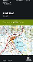
 | TN08 Tiberias 1:50.000 Topographische Landkarte Tasmanien - Australien - Tasmap (Tasmanien) |
 | 3124 04 Vahvaselkä Topographische Karte 1:20.000 (Maastokartta / Peruskartta / Grundkarta) Maanmittauslaitos / Lantmäteriverket Finnland - ProjektNord |
 | Schweden Eisenbahn und Straße 1:900.000 - Landkarte - ITMB International Travel Reference Maps (engl.) Sweden Railway & Road ITMB International Travel Maps (engl.) |
 | Cornwall Reisekarte 1:126.720 Touring map & travel guides - Goldeneye mapguides (engl.) Cornwall touring mapguide Goldeneye Publications - Großbritannien |
 | Japanese Alpine News Vol. 16 - 2015 The Japanese Alpine Club |
 | Vall de Cardó 1:5.000 50è dia del camí de Muntanya - Wanderkarte - Editorial Piolet - Spanien |
 | 4545 Mühlberg/Elbe Sonderausgabe mit Wanderwegen - Topographische Wanderkarte Brandenburg 1:25.000 ProjektNord |
 | 8012 Freiburg im Breisgau Südwest Topographische Landkarte 1:25.000 - Landesvermessungsamt Baden-Württemberg |
 | Sardinien Nord und Süd - Set aus 2 Straßenkarten - Autokarten 1:150.000 Top 10 Tips - Freytag-Berndt und ARTARIA |
 | Nähere Umgebung von Breslau (Südost) - Wanderkarte 1:50.000 Bliskie okolice Wrocławia część południowo-wschodnia PLAN Galileos - Polen |
 | Germany Northwest - Schleswig-Holstein - Hamburg - Niedersachsen - Bremen Regionale Straßenkarte 1:350.000 (Blatt 541) Michelin |
 | Alta Valle Brembana (Foglio 2) 1:25.000 Ingenia Editori - Wanderkarte - Italien |
 | 8026 Aitrach Topographische Landkarte 1:25.000 - Landesvermessungsamt Baden-Württemberg |
 | Elsass und Vogesen Reiseführer Reise-Know-How Verlag |
 | Sizilien West und Ost - Set aus 2 Straßenkarten - Freizeitkarten 1:150.000 Top 10 Tips - Freytag-Berndt und ARTARIA |
 | Lienzer Dolomiten - Lesachtal - Karnischer Höhenweg 1:50.000 (Nr. 47) 4in1 Wanderkarte 1:50000 mit Aktiv Guide und Detailkarten inklusive Karte zur offline Verwendung in der KOMPASS-App. Fahrradfahren - KOMPASS-Karten GmbH |
 | 2035 Neuburg Amtliche Topographische Karte 1:25.000 Landesvermessungsamt Mecklenburg-Vorpommern |
 | Comer See - von Eberhard Fohrer - Michael-Müller-Verlag |
 | Calvi - Cargèse - Monte Cinto - Monte Rotondo 1:75.000 (Blatt 29) touristische Wanderkarte Tourisme et Randonnée TOP75 - IGN Frankreich |
 | 4304 Xanten - Wanderkarte mit Wanderwegen (geplottete Ausgabe) ProjektNord - Grundlage Amtliche topographische Karte 1:25.000 Landesvermessungsamt Nordrhein-Westfalen |