| << Tasmap << Tasmanien |
  | |
|
||
Zuletzt angesehene Artikel:
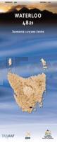
![]() | Waterloo 1:25.000 Topographische Landkarte Tasmanien - Australien - Tasmap (Tasmanien) |
![]() | Normandie 1:200.000 Straßenkarte Frankreich - (Blatt 513) Michelin Regional |
![]() | 1919 Dieksand Topographische Landkarte 1:25.000 Landesvermessungsamt Schleswig-Holstein |
![]() | 1830SB Confolens - Champagne-Mouton - GPS Amtliche Topographische Wanderkarte Frankreich 1:25.000 - série bleue (IGN) |
![]() | 2614SB La Ferté-Gaucher - Montmirail GPS Amtliche Topographische Wanderkarte Frankreich 1:25.000 - série bleue (IGN) |
![]() | 1216 Borgsum (Föhr) Topographische Landkarte 1:25.000 Landesvermessungsamt Schleswig-Holstein |
![]() | 2740ET CORNICHES DES CÉVENNES - Parc National des Cévennes Topographische Wanderkarte Frankreich 1:25.000 TOP 25 IGN |
![]() | 206 N Rolvsøya NORD 1:50.000 - Amtliche Topographische Landkarte Norwegen - Startens Kartverk |
![]() | 2023 Itzehoe Topographische Landkarte 1:25.000 Landesvermessungsamt Schleswig-Holstein |
![]() | 2506SB Douai - Rouvroy - Vitry-en-Artois GPS Amtliche Topographische Wanderkarte Frankreich 1:25.000 - série bleue (IGN) |
![]() | 4234 Aschersleben Topographische Karte 1:25.000 Landesamt für Vermessung und Geoinformation Sachsen-Anhalt (Landesvermessungsamt) |
![]() | 2717SB Estissac - Marigny-le-Châtel GPS Amtliche Topographische Wanderkarte Frankreich 1:25.000 - série bleue (IGN) |
![]() | 2934ET BOURG-ARGENTAL Topographische Wanderkarte Frankreich 1:25.000 TOP 25 IGN |
![]() | 1514SB Condé-sur-Noireau - Clécy - Suisse Normande GPS Amtliche Topographische Wanderkarte Frankreich 1:25.000 - série bleue (IGN) |
![]() | 2323SB ST-MARTIN-DAUXIGNY - FOËCY GPS Amtliche Topographische Wanderkarte Frankreich 1:25.000 - série bleue (IGN) |
![]() | Remscheid 1962 (Blatt 36) Historischer Bildstadtplan Bollmann-Bildkarten-Verlag |
![]() | 118 Oberpfälzer Wald - Tachau - Fahrradkarte Tschechien 1:70.000 Ceský les - Tachovsko - cykloturistická mapa KARTOGRAFIE PRAHA |
![]() | 1839SB VILLENEUVE-SUR-LOT - CASTELMORON-SUR-LOT GPS Amtliche Topographische Wanderkarte Frankreich 1:25.000 - série bleue (IGN) |
![]() | 2343ET CASTRES / LE SIDOBRE Topographische Wanderkarte Frankreich 1:25.000 TOP 25 IGN |
![]() | 2136 Neukloster Amtliche Topographische Karte 1:25.000 Landesvermessungsamt Mecklenburg-Vorpommern |


