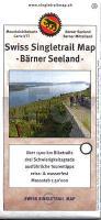
| << Snow-Trail-Karten und Singletrailkarten << Schweiz: MTB-Karten Single Trail Map 1:50.000 und Supertrail Map 1:50.000 |
  | |
|
||
Zuletzt angesehene Artikel:
![]() | 13 Berner Seeland MTB-Karte 1:50.000 - Swiss Singletrail Map |
![]() | 24-12 Topographische Karte 1:50.000 der Tschechischen Republik Zakladnà mapa Ceská republika - Cesky urad zememericky a katastralni - ProjektNord |
![]() | 274.24 Amtliche topographische Karte 1:25.000 Polen |
![]() | 4348OT BASTIA Topographische Wanderkarte Frankreich 1:25.000 TOP 25 IGN |
![]() | Helsinki & Süd-Finnland 1:10.000 / 1:750.000 - Landkarte - ITMB International Travel Reference Maps (engl.) Helsinki & Finland South - ITMB International Travel Maps (engl.) |
![]() | 48 Finspång 1:50.000 (wasserfest) Topographische Wanderkarte - Sverigeserien Topo50 - Schweden Kartförlaget |
![]() | Alta Badia (6) FunBike MTB-Gebietsführer Südtirol Bike Arena |
![]() | 2840OT ALES Topographische Wanderkarte Frankreich 1:25.000 TOP 25 IGN |
![]() | 1215OT LE MONT-ST-MICHEL Topographische Wanderkarte Frankreich 1:25.000 TOP 25 IGN - (GPS) |
![]() | 4251OTR MONTE D`ORO / MONTE ROTONDO - PNR de Corse - Topographische Wanderkarte Frankreich 1:25.000 (LAMINIERTE AUSGABE) TOP 25 IGN - (GPS) |
![]() | 2631SB Thiers - Pont-du-Château GPS Amtliche Topographische Wanderkarte Frankreich 1:25.000 - série bleue (IGN) |
![]() | Q5222 Manamansalo Topographische Karte 1:25.000 EUREF (Peruskartta) Maanmittauslaitos / Lantmäteriverket Finnland - ProjektNord |
![]() | 2048OT AULUS LES BAINS - Mont Valier Topographische Wanderkarte Frankreich 1:25.000 TOP 25 IGN - (GPS) |
![]() | 2606SB Valenciennes - Denain GPS Amtliche Topographische Wanderkarte Frankreich 1:25.000 - série bleue (IGN) |
![]() | Sirdalsheiane Wanderkarte Norwegen 1:50.000 (Blatt 2543) - Nordeca / UGLAND / Statens Kartverk Norwegen |
![]() | 24-143 Topographische Karte 1:25.000 der Tschechischen Republik Zakladnà mapa Ceská republika Cesky urad zememericky a katastralni - ProjektNord |
![]() | 411.12 Amtliche topographische Karte 1:25.000 Polen |
![]() | 2232SB Bugeat - Peyrelevade GPS Amtliche Topographische Wanderkarte Frankreich 1:25.000 - série bleue (IGN) |
![]() | 23-132 Topographische Karte 1:25.000 der Tschechischen Republik Zakladnà mapa Ceská republika Cesky urad zememericky a katastralni - ProjektNord |
![]() | 2347OT QUILLAN - ALET-LES-BAINS Topographische Wanderkarte Frankreich 1:25.000 TOP 25 IGN - (GPS) |


