 Doppelseitig bedruckte topographische Wanderkarte, die auf dem sythetischen Papier Polyart gedruckt ist.
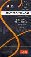
wasserfest und reißfest Die Karte erstreckt sich von der Bozzi Hütte bis nach Caoria. Blattübersicht 1:50.000  Sentiero Italia und Einzelblätter Sentiero Italia und Einzelblätter
Blattübersicht 1:25.000 und detaillierter Westalpen Mittlere Alpen: Südtirol, Dolomiten Toskana Mittelitalien Sardinien Kartenausschnitt
|
Blatt 11A: Rifugio Bozzi - Caoria 1:50.000 - Wanderkarte - Sentiero Italia Trentino Alto Adige CAI - 4land / Idea Montagna
Carta itineraria del Sentiero Italia tratto in Trentino Alto Adige, dal Rifugio Bozzi a Caoria 4land / Idea Montagna
EAN / ISBN: 9791280496386
Preis: EUR 16.90
|
| 
