| << Schweden: Topographische Wanderkarten Sverigeserien 1:50.000 |
  | |
Zuletzt angesehene Artikel:
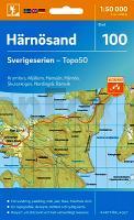
![]() | 100 Härnösand 1:50.000 (wasserfest) Topographische Wanderkarte - Sverigeserien Topo50 - Schweden Kartförlaget |
![]() | 326 Ayr & Troon - Wanderkarte Großbritannien 1:25.000 EXPLORER MAP - Ordnance Survey |
![]() | New Castle / Sharon / Hermitage / Lawrence & Mercer Co. Stadtplan 1:32.000 (Pennsylvania - USA) New Castle / Sharon / Hermitage / Lawrence & Mercer Co. street map GM Johnson |
![]() | Norwegen - Straßenkarte Nordnorwegen Nord 1:500.000 Veikart Nord-Norge Nord Nordeca / UglandIT / Statens Kartverk - Norwegen |
![]() | 221 Coventry & Warwick - Royal Leamington Spa & Kenilworth - Wanderkarte Großbritannien 1:25.000 EXPLORER MAP - Ordnance Survey |
![]() | 1226SB Le Poiré-sur-Vie - Aizenay - Les Achards GPS Amtliche Topographische Wanderkarte Frankreich 1:25.000 - série bleue (IGN) |
![]() | 12 Bassa Valle di Ayas e del Lys (wasserfest) Topographische Wanderkarte 1:25.000 l`Escursionista Editore - Italien |
![]() | 14-132 Topographische Karte 1:25.000 der Tschechischen Republik Zakladnà mapa Ceská republika Cesky urad zememericky a katastralni - ProjektNord |
![]() | 19 Armagh - Wanderkarte Nord-Irland 1:50.000 DISCOVERER MAP - Ordnance Survey |
![]() | 062 North Kintyre & Tarbert - Wanderkarte Großbritannien 1:50.000 LANDRANGER MAP - Ordnance Survey |
![]() | Gainesville / Hall County Stadtplan 1:32.000 (Georgia - USA) Gainesville / Hall County street map GM Johnson |
![]() | 25/1-2 TESSENDERLO NGI 1:25.000 Topographische Landkarte Belgien |
![]() | 2726SB Bourbon-Lancy - Grury GPS Amtliche Topographische Wanderkarte Frankreich 1:25.000 - série bleue (IGN) |
![]() | U4224 Reponiemi Topographische Karte 1:25.000 EUREF (Peruskartta) Maanmittauslaitos / Lantmäteriverket Finnland - ProjektNord |
![]() | 24-13 Bystřice nad Pernštejnem (Bystrice nad Pernstejnem) Topographische Karte 1:50.000 der Tschechischen Republik Zakladnà mapa Ceská republika - Cesky urad zememericky a katastralni - ProjektNord |
![]() | 1727SB Poitiers - Coulombiers GPS Amtliche Topographische Wanderkarte Frankreich 1:25.000 - série bleue (IGN) |
![]() | 3118SB Chaumont - Biesles GPS Amtliche Topographische Wanderkarte Frankreich 1:25.000 - série bleue (IGN) |
![]() | 112 Valle Stura - Vinadio - Argentera - Bagani di Vinadio - Topographische Wanderkarte 1:25.000 - IGC Italien |
![]() | Bandite di Scarlino 1:15.000 (BS) - Wanderkarte - D.R.E.A.M. Italia Carta dei sentieri delle Bandite di Scarlino |
![]() | 173.12 Amtliche topographische Karte 1:25.000 Polen |


