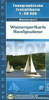
| << Berlin und Brandenburg: Topographische Freizeitkarten 1:25.000 - 1:50.000 - Landesvermessung und Geobasisinformation Brandenburg / ProjektNord << Berlin / Brandenburg: Wassersportkarten und Kanuführer |
  | |
Zuletzt angesehene Artikel:
![]() | 22 Wassersportkarte Havelgewässer GPS Topographische Freizeitkarte Wassersport 1:50.000 Landesvermessung und Geobasisinformation Brandenburg |
![]() | 20 Hohe Eifel - Vulkaneifel 1:35.000 Outdoorkarte - Wanderkarte Nürburgring, Daun, Gerolstein - Kümmerly & Frey |
![]() | Biker- und Erlebniskarte Harz 1:175.000 KKV - Kartographische Kommunale Verlagsgesellschaft |
![]() | 2322 Stade Nord Topographische Wanderkarte 1:25.000 Niedersachsen mit Wanderwegen - ProjektNord |
![]() | Athen (Blatt 291) Laminierter Stadtplan Αθήνα - Athens Orama - Griechenland |
![]() | 151 Stratford-upon-Avon - Warwick & Banbury - Wanderkarte Großbritannien 1:50.000 Active Laminiert LANDRANGER MAP - Ordnance Survey |
![]() | OL5 The English Lakes - North-eastern area - Penrith, Patterdale & Caldbeck - laminierte Wanderkarte Großbritannien 1:25.000 EXPLORER MAP - Ordnance Survey |
![]() | 3242 Königshorst Sonderausgabe mit Wanderwegen - Topographische Wanderkarte Brandenburg 1:25.000 ProjektNord |
![]() | Green Mountain National Forest South (Blatt 748) GPS (AK) Landkarte - Trails Illustrated Map - National Geographic - USA National Geographic |
![]() | Yorkshire Wolds Way Wanderkarte 1:40.000 (wasserfest) National Trail hiking map Yorkshire Wolds Way XT40 HARVEY MAPS - Großbritannien |
![]() | 169 Ipswich & The Naze - Clacton-on-sea - Wanderkarte Großbritannien 1:50.000 Active Laminiert LANDRANGER MAP - Ordnance Survey |
![]() | 285T Domodossola - Parco Nazionale Val Grande (I) 1:50.000 Topographische Wanderkarte SAW der Schweiz - swisstopo Domodossola - Parco Nazionale Val Grande |
![]() | 136 Comune di Grauno e Zone Limitrofe 1:10.000 - Topographische Wanderkarte - 4land - Italien Carta dei Sentierie del Comune di Grauno e Zone Limitrofe |
![]() | L4922 Melsungen (geplottete Ausgabe) Topographische Landkarte Hessen 1:50.000 - ProjektNord |
![]() | 2919 Bremen Ost Amtliche topographische Karte 1:25.000 Landesvermessungsamt Niedersachsen |
![]() | Klettern in Östergötland Kletterführer schwedisch Klättring i Östergötland Calazo Förlag Schweden |
![]() | Pommern PLANO Historische Übersichtskarte 1:300.000 - BKG Bundesamt für Kartographie und Geodäsie |
![]() | Historische WELTKARTE 1641 - Henricus Hondius - Historische Landkarte Originalinschrift der World Map: Nova Totivs Terrarvm Orbis Geographica Ac Hydrographica Tabvla | Weltkarten Vol. 2 - von Hondius Henricus - PLANO gerollt - Verlag Rockstuhl |
![]() | 283 AROLLA 1:50.000 - Grand Combin - Lac des Dix - Matterhorn - Topographische Landeskarte der Schweiz - swisstopo |
![]() | 3948 Oderin Sonderausgabe mit Wanderwegen - Topographische Wanderkarte Brandenburg 1:25.000 ProjektNord |


