| << Russland: Oblaste und Regionen etc. << Rus Co. Ltd. |
||
|
||
Zuletzt angesehene Artikel:
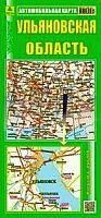
 | Oblast Uljanowsk 1:450.000 Straßenkarte / Regionalkarte - Russland Ulyanowskaya oblast Rus Co. Ltd. |
 | Ung. Hradisch Topographische Karte 1:25.000 Messtischblatt des Deutschen Reiches - Preußische Landesaufnahme / Reichsamt für Landesaufnahme - Faksimile ProjektNord |
| Ust-Kut Stadtplan - Stadtplan mit Umgebungskarte Усть-Кут / Ust` - Kut i okrestnosti Karta FGUP Vostočno sibirskoe aerogeodezičekoe predprijatie - VostSib AGP |
 | 1842 02+03 Urtasvaara Topographische Karte 1:20.000 (Maastokartta / Peruskartta / Grundkarta) Maanmittauslaitos / Lantmäteriverket Finnland - ProjektNord |
 | U414 Kolari Topographische Karte 1:50.000 EUREF-FIN (Maastokarttat) Maanmittauslaitos / Lantmäteriverket Finnland - ProjektNord |
| 1490 Uderwangen Topographische Karte 1:25.000 Messtischblatt des Deutschen Reiches - Preußische Landesaufnahme / Reichsamt für Landesaufnahme - Faksimile ProjektNord |
 | Oberösterreich 1:150.000 *** SCHNÄPPCHEN *** Auto- + Freizeitkarte Upper Austria - Alta Austria - Austria superiore - Haute Autriche freytag & berndt |
 | Unteres Saaletal, Weißenfels, Merseburg, Zeitz und Umgebung - Radwander- und Wanderkarte 1:50.000 (Nr. 062) Ausflüge zwischen dem Geiseltalsee, Naumburg, Lützen, Osterfeld, Droyßig, Bad Dürrenberg und Bad Lauchstädt. Radwander- und Wanderkarte, Radtourenvorschläge m. Entfernungsangaben. Viele Tipps zu Sehenswürdigkeiten. GPS-fähig Dr. Barthel Verlag |
 | Yosemite - Day Hikes 1:50.000 (Blatt 1704) California US National Parks - National Geographic - USA |
 | Moab Area East - Dewey Bridge, Sand Flats (Blatt 507) GPS (UT) 1:90.000 Landkarte - Trails Illustrated Map - National Geographic - USA National Geographic |
 | Tag und Nacht FIXI-LearnCards STIEFEL Eurocart |
 | Navoiy Stadtplan 1:20.000 - Provinz Navoiy 1:1 Mio. Navoiy / Navoiy viloyat Yergeodezkadastr Davlat Qo´Mitasi - Usbekistan |
 | Oblast Kiew 1:250.000 (kyrillisch) Landkarte, Straßenkarte - Ukraine mit Hauptstraßen-Stadtplan Kiew Kijivska Oblast / Київська область Kartografija - ukrmap Ukraine |
 | Dubai / UAE / Oman 1:15.000 - 1:950.000 *** SCHNÄPPCHEN *** - ITMB International Travel Reference Map |