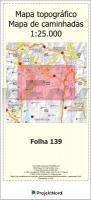
 Auf der Grundlage der OpenStreetMap und im bekannten Blattschnitt der Militärkarte Carta Militar de Portugal Série M888 1:25.000 vom Instituto Geográfico do Exército gibt ProjektNord diese Serie topographischer Wanderkarten 1:25.000 über das gesamte Land heraus. Durch i.d.R. sofortige Lieferbarkeit entfallen lange Wartezeiten gegenüber den Militärkarten.  Blattübersicht als PDF-Datei Blattübersicht als PDF-Datei
Kartenbeispiel aus der Serie Mit Wanderwegen, Radrouten, Gastronomie, Haltestellen, kleinsten Pfaden und Wegen, soweit die Kartengrundlage vorangeschritten ist. Die Karten verwenden den gleichen Blattschnitt wie die amtliche Serie M888. Allerdings enthalten sie zusätzliche touristische Informationen und decken ein etwas größeres Gebiet ab (sie überlappen großzügig mit Nachbarblättern). Sie sind also mit den amtlichen Landkarten kombinierbar. HINWEISE: Bereiche außerhalb der Staatsgrenzen Portugals werden ohne Kartografie dargestellt (bleiben also weiß). In Ausnahmefällen ist es möglich, dass dort eine Ersatz-Kartografie, z.B. aus Spanien eingesetzt wird. Darauf besteht jedoch kein Anspruch. Die Karten werden auf Kundenbestellung gedruckt und sind daher vom Umtausch ausgeschlossen. Wenn Sie unsicher sind, welche Karten Sie benötigen, treten Sie bitte vorher mit uns in Kontakt. Kartenausschnitt
|
139 Topographische Landkarte Wanderkarte und Fahrradkarte Portugal 1:25.000
139 Mapa topográfico - Mapa de caminhadas - Portugal 1:25.000 ProjektNord
Preis: EUR 19.90
|
| 


