Willkommen bei MapFox
+++ Buchhändleranfragen willkommen! Tel. 0431-666 75 99 +++
Warenkorb
Artikel: 0 - € 0.00
Zur Kasse
Impressum Kontakt Versandkosten AGB
5A: Ait Mansour West - Tafraout - Awmrkt - Tahala & Adrar Amrksou 1:50.000 GPS Outdoor Activity Map for climbers, trekkers and tourists - Oxford Alpine Club
<< Marokko
<< Oxford Alpine Club - OAC
 
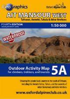
Cover

A special double-sided map showing the region to the south of Tafraout, including the popular tourist destinations of the Ait Mansour and Teneglichte Gorges, the Painted Rocks, Aguerd Oudad, and Tafraout.

OAC MiniMaps are the most detailed and accurate maps currently available for Morocco`s Anti-Atlas mountains near Tafraout. These 1:50000 scale maps are drawn in a similar style to British OS maps, and are ideal for all outdoor activities in the Anti-Atlas region, including hillwalking, climbing, and scrambling, as well as exploring the region by car or bike.

The Anti-Atlas range is covered by 5 miniMap sheets as follows:

Sheet 1: Jebel Taskra massif, showing the Tizi N`Takoucht escarpment from Idaougnidif to Taskra, including the Kasbah Tizourgane and Aouguenz road.

Sheet 2: Tanalt, showing the Amaghouz Gorge, Tanalt, Tagzene, Tagmout, Samazar and western Afantinzar.

Sheet 3: Ameln, showing the summit of Jebel el Kest, the Ameln Valley, Tarakatine Pass and the eastern escarpment of Sidi M`Zal.

Sheet 4: Tafraout, showing the granite back-country including Aguerd Oudad and the Painted Rocks.

Sheets 5A and 5B: Ait Mansour, showing the popular tourist routes from Tafraout through Aguerd Oudad, the Painted Rocks, and the Ait Mansour and Teneglichte Gorges.

Blattschnitte der Outdoor Activity Maps

Blattübersicht aller Karten vom Oxford Alpine Club

Kartenbeispiel

5A: Ait Mansour West - Tafraout - Awmrkt - Tahala & Adrar Amrksou 1:50.000 GPS Outdoor Activity Map for climbers, trekkers and tourists - Oxford Alpine Club
Preis: EUR 14.90

Dieser Titel ist momentan nicht lieferbar.
Produkt EUR Anzahl Bestellen
5A: Ait Mansour West - Tafraout - Awmrkt - Tahala & Adrar Amrksou 1:50.000 GPS Outdoor Activity Map for climbers, trekkers and tourists - Oxford Alpine Club 14.90
Versandkostenfrei in Deutschland ab 20,- Bestellwert

incl. MwSt.

Stichworte, die bei der Suche nützlich sein könnten:
Anti-Atlas - Anti-Atlas Landkarte - Anti-Atlas Wanderkarte - Antiatlasgebirge Wanderkarte - Antiatlas Wanderkarte - Antiatlas Landkarte - Ait Mansour Gorge - Tafraout Wanderkarte - Marocco Hiking Map - Marokko Kletterkarte - Antiatlasgebirge - Antiatlas - Tafraout Landkarte - Ait Mansour - Tafraout - Antiatlasgebirge Landkarte - Marokko Wanderkarte - Oxford Alpine Club - Marokko - Marokko - Marokko Straßenkarten - Marokko Atlanten - Marokko Wanderkarten - Marokko Karten - Marokko Fahrradkarten - Marokkokarten - Marokko Kartografie - Marokko Radwanderführer - Marokko Kartographie - Marokko Radwanderkarten - Marokko Reiseführer - Marokko Landkarten - Marokko Landkartenverkauf - Morocco - Morocco maps - Marokko Kletterkarten - Marokko Kletterführer - Anti-Atlas Gebirge - Atlasgebirge

Zuletzt angesehene Artikel:

Cover5A: Ait Mansour West - Tafraout - Awmrkt - Tahala & Adrar Amrksou 1:50.000 GPS Outdoor Activity Map for climbers, trekkers and tourists - Oxford Alpine Club

CoverGabun & Kamerun 1:980.000 / 1:1.3 Mio. Landkarte - ITMB International Travel Maps (engl.)
Gabon & Cameroon

Cover282T MARTIGNY - Chamonix-Mont-Blanc - Lac d`Emosson - Val d`Entrement 1:50.000 Topographische Wanderkarte SAW der Schweiz - swisstopo

Cover2 NORD-OST SCHWEIZ 1:200.000 - Zentralschweiz - Bodensee - Vorarlberg - Topographische Landeskarte der Schweiz - swisstopo

Noch kein Cover vorhandenVancouver , Greater Stadtplanatlas 1:21.000 Map Book (British Columbia - Kanada)
Vancouver , Greater Map Book street Pathfinder Maps (GM Johnson)

CoverCoast to Coast Walk Part 1: West - St Bees to Swaledale - Wanderkarte Footprint Maps - Stirling Surveys

CoverNE527 Manthali - Jiri - Pikey Peak - Lower Solu - Everest 1:125.000 - Trekkingkarte - Himalayan MapHouse - Nepal

CoverBarcelona 1:10.000 Stadtplan
Barcelone Barcellona freytag & berndt

CoverLisbon city map Planungskarte (engl.) Lonely Planet

CoverBodensee Euregio 1:50.000 Wanderkarte - GeoMap

CoverBarcelona Stadtplan 1:20.000 Mini comfort!map wasserfest - laminiert - ExpressMap

CoverEcuador The premier guidebook for Business Globetrotters (englisch) eBiz Guides

CoverNordkalotte - Nordkap 1:800.000 Autokarte
Pohjoiskalotti Nordkapp / Nordkalotten Matkailukartta ja Opas - Suomen, Ruotsin ja Norjan pohjoisosan tiekartta Karttakeskus / Genimap

CoverYorkshire Dales Cycle Way Radwanderkarte 1:100.000 Cycle Route NY10 - HARVEY MAPS
Yorkshire Dales Cycle Way - Cycle Route NY10 - Cycling Map

CoverEcuador - Galapagos 1:800.000 Auto + Freizeitkarte freytag & berndt

CoverUkraine - Krim 1:1 Mio. Landkarte - ITMB International Travel Reference Maps (engl.)
Ukraine & Moldova (incl. Crimea)

CoverTongariro Circuit & Round the Mountain Track 1:40.000 + Track Guide Wanderkarte - Neuseeland Geographx - Craig Potton Publishing Neuseeland

CoverOsteuropa 1:2 Mio. Auto- + Freizeitkarte
Eastern Europe - Europa del Este - Oost Europa - Europa de l` Est - Europa orienta freytag & berndt

CoverElsass - Vogesen - Wandern & Einkehren - 50 Touren - mit GPS-Daten - Bergverlag Rother

Cover1128 LANGENTHAL 1:25.000 - Madiswil - Huttwil - Zell - Topographische Landeskarte der Schweiz - swisstopo