Willkommen bei MapFox
+++ Buchhändleranfragen willkommen! Tel. 0431-666 75 99 +++
Warenkorb
Artikel: 0 - € 0.00
Zur Kasse
Impressum Kontakt Versandkosten AGB
1: Taskra - Idaougnidif - Tizourgane - Asseldrar - Aoudid & Takoucht (wasserfest) 1:50.000 GPS Outdoor Activity Map for climbers, trekkers and tourists - Climb Tafraout - minimap - Oxford Alpine Club
<< Marokko
<< Oxford Alpine Club - OAC
 
Cover

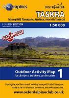
A new GPS edition of our popular 1:50000 scale outdoor activity map of the Jebel Taskra massif, including Idaougnidif, Kasbah Tizourgane, Asseldrar, the Tizi N`Takoucht escarpment, and the Aouguenz road.

OAC MiniMaps are the most detailed and accurate maps currently available for Morocco`s Anti-Atlas mountains near Tafraout. These 1:50000 scale maps are drawn in a similar style to British OS maps, and are ideal for all outdoor activities in the Anti-Atlas region, including hillwalking, climbing, and scrambling, as well as exploring the region by car or bike.

The Anti-Atlas range is covered by 4 miniMap sheets as follows:

Sheet 1: Jebel Taskra massif, showing the Tizi N`Takoucht escarpment from Idaougnidif to Taskra, including the Kasbah Tizourgane and Aouguenz road.

Sheet 2: Tanalt, showing the Amaghouz Gorge, Tanalt, Tagzene, Tagmout, Samazar and western Afantinzar.

Sheet 3: Ameln, showing the summit of Jebel el Kest, the Ameln Valley, Tarakatine Pass and the eastern escarpment of Sidi M`Zal.

Sheet 4: Tafraout, showing the granite back-country including Aguerd Oudad and the Painted Rocks.

Blattschnitte der Outdoor Activity Maps

Blattübersicht aller Karten vom Oxford Alpine Club

Kartenausschnitt

Kartenbeispiel

1: Taskra - Idaougnidif - Tizourgane - Asseldrar - Aoudid & Takoucht (wasserfest) 1:50.000 GPS Outdoor Activity Map for climbers, trekkers and tourists - Climb Tafraout - minimap - Oxford Alpine Club
Preis: EUR 14.90

Dieser Titel ist momentan nicht lieferbar.
Produkt EUR Anzahl Bestellen
1: Taskra - Idaougnidif - Tizourgane - Asseldrar - Aoudid & Takoucht (wasserfest) 1:50.000 GPS Outdoor Activity Map for climbers, trekkers and tourists - Climb Tafraout - minimap - Oxford Alpine Club 14.90
Versandkostenfrei in Deutschland ab 20,- Bestellwert

incl. MwSt.

Stichworte, die bei der Suche nützlich sein könnten:
Antiatlas - Taskra - Tafraout - Tizourgane - Idaougnidif - Antiatlasgebirge - Antiatlas Landkarte - Anti-Atlas - Takoucht - Marokko Kletterkarte - Asseldrar - Oxford Alpine Club - Anti-Atlas Landkarte - Aoudid - Anti-Atlas Wanderkarte - Antiatlas Wanderkarte - Marocco hiking map - Antiatlasgebirge Wanderkarte - Marokko - Marokko Straßenkarten - Marokko Atlanten - Marokko Wanderkarten - Marokko Karten - Marokko Fahrradkarten - Marokkokarten - Marokko Kartografie - Marokko Radwanderführer - Marokko Kartographie - Marokko Radwanderkarten - Marokko Reiseführer - Marokko Landkarten - Marokko Landkartenverkauf - Morocco - Morocco maps - Marokko Kletterkarten - Marokko Kletterführer - Anti-Atlas Gebirge - Atlasgebirge

Zuletzt angesehene Artikel:

Cover1: Taskra - Idaougnidif - Tizourgane - Asseldrar - Aoudid & Takoucht (wasserfest) 1:50.000 GPS Outdoor Activity Map for climbers, trekkers and tourists - Climb Tafraout - minimap - Oxford Alpine Club

CoverCK61: Oslo innerhalb Ring 3 Stadtplan 1:10.000
Oslo - innenfor Ring 3 Cappelens Kart - Norwegen

Cover21 Il Canavese da Ivrea a Chivasso (mit Radwegen) - Topographische Wanderkarte 1:50.000 IGC Italien

Cover4: Tafraout 1:25.000 GPS Wanderkarte - Tafraout - Awmrkt - the painted Rocks & Adrar Mqorn - wasserfest Adventurer Map for climbers, trekkers and tourists - Oxford Alpine Club

CoverColline di San Luca - Bologna (Blatt 01 BO) Wanderkarte 1:25.000
Colline di San Luca - Bologna Carta escursionistica 01BO l´Escursionista Editore Italien

CoverDenver Street Map - CO Stadtplan - Rand McNally - USA

CoverHong Kong city map Planungskarte (engl.) Lonely Planet

CoverSpringer & Cohutta - GA (Blatt: 777) Landkarte Trails Illustrated Map National Geographic - USA

CoverMarokko 1:1.1 Mio. / 1:1.5 Mio. Landkarte (wasserfest) - ITMB International Travel Maps (engl.)
Morocco

Cover01 VE Asolo e i Colli Asolani (Alpen Venezien) Wanderkarte 1:25.000 - ZetaBeta Italien

CoverWandern mit Hund Rund um Stuttgart 40 Touren. Mit GPS-Daten - von Martin Kuhnle - Bergverlag Rother

Cover32 MAYO - ROSCOMMON - SLIGO Wanderkarte Irland 1:50.000 DISCOVERY MAP - Ordnance Survey

CoverLake Waikaremoana Track 1:40.000 + Track Guide Wanderkarte - Neuseeland Geographx - Craig Potton Publishing Neuseeland

CoverTeheran Stadtplan 1:15.000 und Nord Iran Landkarte 1:1.8 Mio. (engl.)
Tehran and Northern Iran ITMB International Travel Maps (engl.)

CoverAlberta 1:940.000 (Kanada) - Calgary - Edmonton - Banff - Jasper - Lake Louise - Landkarte - ITMB International Travel Maps (engl.)

CoverWestliche Slowakei Von Bratislava bis zu den Beskiden. 58 Touren mit GPS-Tracks - von Martin Moder - Bergverlag Rother

Cover19 Sarganserland MTB-Karte 1:50.000 - Swiss Singletrail Map

CoverNL511 Langtang - Tamang Heritage Trail 1:125.000 / Langtang Gosainkund & Helambu 1:125.000 Himalayan MapHouse - Nepal

CoverSolowjezki-Inseln 1:50.000 Wanderkarte
Solovetsky Islands / Solowjezkije Ostrowa Aero Geodesija - Russland

CoverParque Nacional Los Glaciares - Minimap 1:400.000 Argentinien / Chile ZAGIER & URRUTY PUBLICATIONS