| << Cookinseln - Tokelau-Inseln - Niue - Kermadecinseln |
||
|
||
Zuletzt angesehene Artikel:
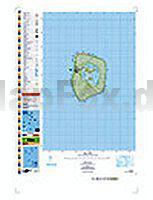
 | PI18 Mitiaro (Cookinseln) Topographische Landkarte 1:25.000 - Land Information New Zealand |
 | 1: Grupo Plomo 1:50.000 - Valle del Cepo - Valle Yerba Loca - Filo la Parva - Pintor - Leonera - Wander- und Bergsteigerkarte - Andes-handbook - Chile |
 | Valle di Scalve (Foglio 4) 1:25.000 Ingenia Editori - Wanderkarte - Italien Carta dei sentieri della Valle di Scalve in provincia di Bergamo |
 | 3235OT AUTRANS/GORGES DE LA BOURNE Topographische Wanderkarte Frankreich 1:25.000 TOP 25 IGN - (GPS) |
 | 3534 Letzlingen Topographische Karte 1:25.000 Landesamt für Vermessung und Geoinformation Sachsen-Anhalt (Landesvermessungsamt) |
 | 05 Pizzo Badile - Blumone e Crocedomini 1:25.000 - Valle Camonica - La Valle dei Segni - Wanderkarte - Ingenia Editori - Italien |
 | 3236OT VILLARD-DE-LANS/MONT AIGUILLE Topographische Wanderkarte Frankreich 1:25.000 TOP 25 IGN - (GPS) |
 | 3534OT LES TROIS-VALLEES / MODANE / PARC NATIONAL DE LAS VANOISE Topographische Wanderkarte Frankreich 1:25.000 TOP 25 IGN |
 | Parco dei Colli di Bergamo 1:15.000 - Wanderkarte - Ingenia Editori - Italien |
| 3322SB Rioz - Gy GPS Amtliche Topographische Wanderkarte Frankreich 1:25.000 - série bleue (IGN) |
 | 3330OT BELLEGARDE-SUR-VALSERINE Topographische Wanderkarte Frankreich 1:25.000 TOP 25 IGN - (GPS) |
| 3138OT Dieulefit - St-Nazaire-le-Desert - Forêt de Saou Topographische Wanderkarte Frankreich 1:25.000 TOP 25 IGN - (GPS) |
 | 3337OT DEVOLUY Topographische Wanderkarte Frankreich 1:25.000 TOP 25 IGN - (GPS) |
 | 3344OT SAINT-MAXIMIN-LA-SAINTE-BAUME - Barjols - Trets - Mont Aurélien - Topographische Wanderkarte Frankreich 1:25.000 TOP 25 IGN |
| 3135SB ROMANS-SUR-ISERE - ST-MARCELLIN GPS Amtliche Topographische Wanderkarte Frankreich 1:25.000 - série bleue (IGN) |
| 3012SB Varennes-en-Argonne - Ville-sur-Tourbe GPS Amtliche Topographische Wanderkarte Frankreich 1:25.000 - série bleue (IGN) |
 | 35 Flämische Ardennen - Fahrradkarte 1:50.000 Fietskaart 35. Flaamse Ardennen Falk - Belgien |
 | 3532ET LES ARCS / LA PLAGNE - Parc National de la Vanoise - Topographische Wanderkarte Frankreich 1:25.000 TOP 25 IGN |
 | 3038SB MONTELIMAR - LA BEGUDE-DE-MAZENC GPS Amtliche Topographische Wanderkarte Frankreich 1:25.000 - série bleue (IGN) |
| 3133SB LA CÔTE-ST-ANDRE - ST-JEAN-DE-BOURNAY Amtliche Topographische Wanderkarte Frankreich 1:25.000 - série bleue (IGN) |