| << Cookinseln - Tokelau-Inseln - Niue - Kermadecinseln |
||
|
||
Zuletzt angesehene Artikel:
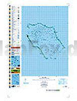
 | PI16 Penrhyn (Cookinseln) Topographische Landkarte 1:50.000 - Land Information New Zealand |
 | 39 FLUELAPASS 1:100.000 - Arosa - Davos - Zernez - Scuol - Topographische Landeskarte der Schweiz - swisstopo |
 | Süd-Masuren - 1:100.000 Olsztyn (Allenstein), Mikolajki (Nikolaiken), Szczytno (Ortelsburg), Pisz (Johannisburg), Orzysz (Arys), Jez. Sniardwy (Spirdingsee) - Ortsnamenkarte von Dirk Bloch - BLOCHPLAN |
 | 344.12 Amtliche topographische Karte 1:25.000 Polen |
 | Fürstenberg - Feldberg - Templin (wasserfest) Kartenset 3 Rad-, Wander- und Gewässerkarten 1:35.000 (Feldberger Seen / Fürstenberg - Havel - Lychen - Templin) - Grünes Herz |
 | Pedals du TOURMALET 1:50.000 Fahrradkarte Frankreich - Monteditorial |
 | Pisek 1:25.000 (Blatt 99) PISECKO - Albrechtice nad Vltavou - Křenovice - Milevsko - Orlík nad Vltavou - Písek - Protivín - Putim - Vodňany - Vráž - Zvíkov - Topographische Wanderkarte 1:25.000 Geodezie On Line - Tschechien |
 | 1216 FILISUR 1:25.000 - Lenzerheide/Lai - Aroser Rothorn - Alvaneu - Topographische Landeskarte der Schweiz - swisstopo |
 | 3228OT OYONNAX Topographische Wanderkarte Frankreich 1:25.000 TOP 25 IGN - (GPS) |
 | 127 Orleans - Blois Topographische Touristische Landkarte Tourismus und Fahrrad (wasserfest) - tourisme et vélo plastifiée TOP100 - 1:100.000 - IGN Frankreich |
 | 3545OT SAINT-TROPEZ / SAINTE-MAXIME - Massif des Maures - Topographische Wanderkarte Frankreich 1:25.000 TOP 25 IGN |
 | PI07 Palmerston (Cookinseln) Topographische Landkarte 1:25.000 - Land Information New Zealand |
 | Nordfrankreich - Flandern 1:200.000 Straßenkarte Frankreich - (Blatt 511) Hauts-de-France Michelin Regional |
| 3131 Bergen (Dumme) Topographische Karte 1:25.000 Landesamt für Vermessung und Geoinformation Sachsen-Anhalt (Landesvermessungsamt) |