| << Cookinseln - Tokelau-Inseln - Niue - Kermadecinseln |
||
|
||
Zuletzt angesehene Artikel:
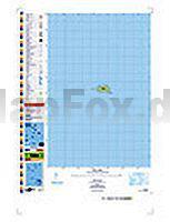
 | PI14 Takutea (Cookinseln) Topographische Landkarte 1:25.000 - Land Information New Zealand |
| Artikel: 0 - € 0.00 |
| << Cookinseln - Tokelau-Inseln - Niue - Kermadecinseln |
||
|
||
Zuletzt angesehene Artikel:
| PI14 Takutea (Cookinseln) Topographische Landkarte 1:25.000 - Land Information New Zealand |