| << Cookinseln - Tokelau-Inseln - Niue - Kermadecinseln |
||
|
||
Zuletzt angesehene Artikel:
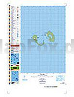
 | PI13 Manuae (Cookinseln) Topographische Landkarte 1:25.000 - Land Information New Zealand |
 | 1344SB Peyrehorade - Hasparren GPS Amtliche Topographische Wanderkarte Frankreich 1:25.000 - série bleue (IGN) |
 | 3034SB Serrières - Anneyron - GPS Amtliche Topographische Wanderkarte Frankreich 1:25.000 - série bleue (IGN) |
| 1926SB Le Blanc / Pleumartin / La Roche-Posay GPS Amtliche Topographische Wanderkarte Frankreich 1:25.000 - série bleue (IGN) |
 | 3437ET ORCIERES-MERLETTE - Sirac - Mourre Froid - Parc National des Écrins - Topographische Wanderkarte Frankreich 1:25.000 TOP 25 IGN - (GPS) |
 | 1629 Panker Topographische Landkarte 1:25.000 Landesvermessungsamt Schleswig-Holstein |
 | 113 Kladensko - Podripsko - Fahrradkarte Tschechien 1:70.000 Kladensko - Podripsko - cykloturistická mapa KARTOGRAFIE PRAHA |
 | Oise - Paris - Val d`Oise Straßenkarte 1:150.000 Frankreich (Blatt 305) Michelin Départements |
 | Neuguinea 1:1.65 Mio. Landkarte - ITMB International Travel Maps (engl.) New Guinea |
 | 139 Pilgrams - Fahrradkarte Tschechien 1:70.000 Pelhrimovsko - cykloturistická mapa KARTOGRAFIE PRAHA |
| 2917SB BRIENNE-LE-CHÂTEAU - PINEY - LACS DE LA FORÊT D`ORIENT GPS Amtliche Topographische Wanderkarte Frankreich 1:25.000 - série bleue (IGN) |
 | 1197 DAVOS 1:25.000 - Weissfluh - Klosters - Flüelatal - Topographische Landeskarte der Schweiz - swisstopo |
 | Piemont - Aostatal 1:200.000 Straßenkarte Italien (Blatt 351) Piemonte - Valle d`Aosta Michelin Local |
 | 0515ET St-Pol-de-Léon - Roscoff - Brignogan - Plade de Batz - Topographische Wanderkarte Frankreich 1:25.000 TOP 25 IGN - (GPS) |
 | 2107OT LE TREPORT Topographische Wanderkarte Frankreich 1:25.000 TOP 25 IGN - (GPS) |
 | 3326ET CHAMPAGNOLE Topographische Wanderkarte Frankreich 1:25.000 TOP 25 IGN - (GPS) |
 | 2786 03 Namche Bajar (20) 1:50.000 Gokyo, Rolwalin Glacier, Tesi Lapcha Pass, Parchamo FINN MAPS - HMG Nepal |
 | 29 Walcheren Forestry commission - Falk - Niederlande |
 | Syrien - Libanon 1:1 Mio. SYRIA - LEBANON - Internationale Landkarte - Cartographia |
 | DUMONT KUNST REISEFÜHRER Peloponnes Mykenische Paläste, antike Heiligtümer und venezianische Kastelle in Griechenlands Süden von Schneider, Lambert |