| << Cookinseln - Tokelau-Inseln - Niue - Kermadecinseln |
||
|
||
Zuletzt angesehene Artikel:
 | PI11 Aitutaki (Cookinseln) Topographische Landkarte 1:25.000 - Land Information New Zealand |
 | 158 Wsetiner Berge - Hosteiner Berge - Fahrradkarte Tschechien 1:70.000 Vsetínské vrchy - Hostýnské vrchy - cykloturistická mapa KARTOGRAFIE PRAHA |
 | Mosel - Kylltal - Meulenwald Topographische Wanderkarte Rheinland-Pfalz mit Wanderwegen und Radwegen 1:25.000 - ProjektNord |
 | 1245OT HENDAYE / SAINT-JEAN-DE-LUZ Topographische Wanderkarte Frankreich 1:25.000 TOP 25 IGN - (GPS) |
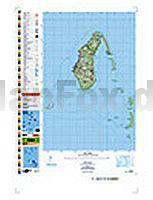
 | PI17 Mangaia (Cookinseln) Topographische Landkarte 1:25.000 - Land Information New Zealand |
 | 4040 Jeber-Bergfrieden Topographische Karte 1:25.000 Landesamt für Vermessung und Geoinformation Sachsen-Anhalt (Landesvermessungsamt) |
 | NL 32-06 Bozen 1:250.000 Bormio - Brixen - Bruneck - Meran - Sterzing - Trento - topographische Landkarte - BEV - Österreich |
| 2441SB Réquista / Villefranche-de-Panat GPS Amtliche Topographische Wanderkarte Frankreich 1:25.000 - série bleue (IGN) |
 | Neuss 2011 1:3.500/1:17.000 (Blatt 348) Bildstadtplan Bollmann-Bildkarten-Verlag |
 | 0618OT Châteauneuf-du-Faou - Vallée l`Aulne - PNR Armorique Topographische Wanderkarte Frankreich 1:25.000 TOP 25 IGN - (GPS) |
 | Frische Nehrung - Polen Topographische Wanderkarte und Touristische Landkarte 1:15.000 Mierzeja Wiślana ProjektNord |
| 2225SB Issoudun / Neuvy-Paillouxt GPS Amtliche Topographische Wanderkarte Frankreich 1:25.000 - série bleue (IGN) |
 | 3540ET HAUTE VALLEE DU VAR Topographische Wanderkarte Frankreich 1:25.000 TOP 25 IGN - (GPS) |
 | PI14 Takutea (Cookinseln) Topographische Landkarte 1:25.000 - Land Information New Zealand |