| << Cookinseln - Tokelau-Inseln - Niue - Kermadecinseln |
||
|
||
Zuletzt angesehene Artikel:
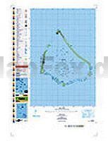
 | PI10 Manihiki (Cookinseln) Topographische Landkarte 1:25.000 - Land Information New Zealand |
 | 052 Pitlochry & Crieff - Wanderkarte Großbritannien 1:50.000 LANDRANGER MAP - Ordnance Survey |
 | Pennine Bridleway cycling - the Dales stages Radwanderführer Cicerone Großbritannien (englisch) |
 | 070 Ayr - Kilmarnock & Troon - Wanderkarte Großbritannien 1:50.000 LANDRANGER MAP - Ordnance Survey |
 | Stockholms Schärengarten Handbuch für Reisen, Kultur und Geschichte - Reiseführer Reise-Know-How Verlag |
 | 039 Rum - Eigg & Muck - Wanderkarte Großbritannien 1:50.000 LANDRANGER MAP - Ordnance Survey |
 | Europa Postleitzahlen 1:3.7 Mio. Wandkarte 96 x 112 cm metallbestäbt in Rolle freytag & berndt |
 | 101 China Geheimtipps und Top-Ziele - Individuelle Tipps - von Volker Häring, Francoise Hauser - Iwanowski |
 | Cycling in the Lake District - The Fred Whitton Challenge - Week-long tours & day rides Radwanderführer Cicerone Großbritannien (englisch) |
 | Irland (Road Map) Straßenkarte 1:300.000 Roadmap of Ireland AA - Automobile Association |
 | Selbstorganisiert Reisen individuell, sicher und günstig - von Holger Krauße - Reise Know-How |
 | Gebrauchsanweisung für Umbrien Übersetzung: Torberg, Peter - von Patricia Clough - Piper Verlag |
 | 101 Barcelona Geheimtipps und Top-Ziele - Reiseführer - Iwanowski´s Reisebuchverlag |
 | CC 4742 Riesa Geologische Übersichtskarte 1:200.000 - Bundesanstalt für Geowissenschaften und Rohstoffe (BGR) |
 | 02 Bodensee West - Thurgau - Wanderkarte 1:40 000 wasserfest - Kümmerly & Frey |
 | Guinea - Reiseführer Afrika - Petit Futé Country Guides (franz.) Guinée |
 | Eschede - Südheide Topographische Wanderkarte mit Wanderwegen und Radwegen 1:25.000 Niedersachsen - ProjektNord |
 | Loire cycling route - from the source in Massif Central to the Atlantic coast Radwanderführer Cicerone Großbritannien (englisch) |
 | Il Parco del Ticino da Sesto Calende a Turbigo 1:50.000 (F. 15) Wanderkarte / Wanderführer E1 - STUDIO CARTOGRAFICO ITALIANO |
 | Lonely Planet Reiseführer Amsterdam von Zimmermann, Karla u. Sieg, Caroline, ver Berkmoes, Ryan |