| << Cookinseln - Tokelau-Inseln - Niue - Kermadecinseln |
||
|
||
Zuletzt angesehene Artikel:
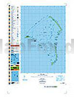
 | PI03 Fakaofo (Tokelau-Inseln) Topographische Landkarte 1:25.000 - Land Information New Zealand |
 | 2009OT FORET D`EAWY Topographische Wanderkarte Frankreich 1:25.000 TOP 25 IGN - (GPS) |
 | National Map of Eritrea 1:1 Mio. Universität Bern |
| M-34-33-C/D Niedrzwica Duza Amtliche topographische Landkarte Polen 1:50.000 M-34-33-C/D Niedrzwica Duza - Mapa Topograficzna Polski Glowny Geodeta Kraju |
 | Trier Topographische Wanderkarte Rheinland-Pfalz mit Wanderwegen und Radwegen 1:25.000 - ProjektNord |
 | 01 La Via dei Campioni 1:25.000 - Costa Vescovato - San Sebastiano Curone - Rad- und Wanderkarte - Ingenia Editori - Italien Carta cicloescursionistica del tratto compreso tra Costa Vescovato e San Sebastiano Curone sulla Via dei Campioni |
| Utö Hafenkarte 167 - 1:10.000 / 1:20.000 Utö 167 Finnland |
 | 0519ET QUIMPER / CONCARNEAU Topographische Wanderkarte Frankreich 1:25.000 TOP 25 IGN - (GPS) |
 | 3519OT REMIREMONT / PLOMBIERES-LES-BAINS Topographische Wanderkarte Frankreich 1:25.000 TOP 25 IGN |
 | Schweiz Südwest 1:200.000 Straßenkarte (Blatt 552) Michelin Regional |
 | Nationalpark Simen-Gebirge Äthiopien - Trekkingkarte 1:120.000 World Heritage Site - Ethiopia Simien Mountains National Park - Trekking map TrekNotes |
 | 2835OT LE PUY-EN-VELAY / YSSINGEAUX Topographische Wanderkarte Frankreich 1:25.000 TOP 25 IGN |
 | 3542OT CASTELLANE - Lac de Castillon - PNR du Verdon - Topographische Wanderkarte Frankreich 1:25.000 TOP 25 IGN |
| 2142SB Villemur-sur-Tarn - Rabastens - GPS Amtliche Topographische Wanderkarte Frankreich 1:25.000 - série bleue (IGN) |
 | 42/1-2 LIEGE NGI 1:25.000 Topographische Landkarte Belgien |
| 2239SB Villefranche-de-Rouergue - Martiel GPS Amtliche Topographische Wanderkarte Frankreich 1:25.000 - série bleue (IGN) |
 | PI11 Aitutaki (Cookinseln) Topographische Landkarte 1:25.000 - Land Information New Zealand |
 | 158 Wsetiner Berge - Hosteiner Berge - Fahrradkarte Tschechien 1:70.000 Vsetínské vrchy - Hostýnské vrchy - cykloturistická mapa KARTOGRAFIE PRAHA |
 | Mosel - Kylltal - Meulenwald Topographische Wanderkarte Rheinland-Pfalz mit Wanderwegen und Radwegen 1:25.000 - ProjektNord |
 | 1245OT HENDAYE / SAINT-JEAN-DE-LUZ Topographische Wanderkarte Frankreich 1:25.000 TOP 25 IGN - (GPS) |