Willkommen bei MapFox
Wurde Ihre Bestellung bestätigt? Wenn nicht - gab es evtl. ein SERVER-Problem! Bitte kontaktieren Sie uns! +++ Buchhändler-Anfragen erwünscht +++
Warenkorb
Artikel: 0 - € 0.00
Zur Kasse
Impressum Kontakt Versandkosten AGB
Durban incl. towns of Kwazulu-Natal Straßenatlas 1:20.000 *** SCHNÄPPCHEN *** (Spiralo) MapStudio Südafrika
<< MapStudio Südafrika
<< Schnäppchen - Restposten - Mängelexemplare
<< Südafrika: Stadtpläne und Stadtführer
 
(Titelbild evtl. abweichend)
Cover

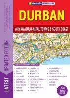
Altauflage 2010, daher zum Sonderpreis.

Includes all the new street names. Content and Coverage: Greater Durban, South Coast, Howick, Kokstad, Mooi River, Scottburgh, Hibberdene, Shelly Beach, Uvongo, Margate, Ramsgate, Port Edward, Empangeni, Ballito, Umhlanga, KwaDukuza (Stanger), Estcourt, Greytown, Ladysmith, Dundee, Newcastle, Vryheid, Pietermaritzburg, Richards Bay, Port Shepstone, Pinetown and Amanzimtoti. Extra Keyplans of map pages adn freeway exits. Airport maps of O.R. Tambo, Cape Town and Durban International Airports. Detailed index of streets adn suburbs, legend on each page. Extended from 216 to 248 pages and taller page format. The index has been simplified to Durban streets and suburbs, main towns index, and all other towns are combined in one easier-to-use index. A special index indicating name changes has been added.

Klicken Sie hier, wenn Sie diesen Artikel in der Version zum normalen Preis sehen möchten.

Kartenausschnitt

Kartenbeispiel

Durban incl. towns of Kwazulu-Natal Straßenatlas 1:20.000 *** SCHNÄPPCHEN *** (Spiralo) MapStudio Südafrika
EAN / ISBN: 9781770267817
Preis: EUR 20.00

sofort versandfertig Dieser Artikel ist im Normalfall sofort lieferbar.
Produkt EUR Anzahl Bestellen
Durban incl. towns of Kwazulu-Natal Straßenatlas 1:20.000 *** SCHNÄPPCHEN *** (Spiralo) MapStudio Südafrika 20.00
Versandkostenfrei in Deutschland ab 30,- Bestellwert

incl. MwSt.

Stichworte, die bei der Suche nützlich sein könnten:
Pietermaritzburg - Estcourt - Stanger - Vryheid - Ramsgate - Greytown - Ballito - Uvongo - Hibberdene - Kwazulu-Natal - Howick - Newcastle - Durban - Richards Bay - Port Edward - Mooi River - Pinetown - Kokstad - Ladysmith - Empangeni - Dundee - Shelly Beach - Port Shepstone - Scottburgh - Umhlanga - KwaDukuza (Stanger) - Amanzimtoti - Margate - MapStudio - Map Studio - Südafrika Landkarten - Südliches Afrika Landkarten - Südafrika Straßenatlanten - Südafrika Autoatlanten - Südafrika Autoatlas - Südafrika Straßenatlas - Lesotho - Swasiland - Botswana - Malawi - Sambia - Zambia - Mosambik - Mozambique - Afrika Landkarten - Südafrikanische Städte - Südafrika Stadtplan - Schnäppchen - Sonderangebote - Restposten

Zuletzt angesehene Artikel:

CoverDurban incl. towns of Kwazulu-Natal Straßenatlas 1:20.000 *** SCHNÄPPCHEN *** (Spiralo) MapStudio Südafrika

Cover6031 Bamberg Nord Topographische Landkarte Bayern 1:25.000 - Normalausgabe - ProjektNord (geplottete Ausgabe) - Grundlage amtliche Topographische Karte Bayern DTK25

Cover224 Kleine Karpaten - Marchauen - Pressburg / Bratislava Touristische Landkarte Slowakei 1:100.000
Male Karpaty, Záhorie, Bratislava - SHOCart

Cover6326 Ochsenfurt Topographische Landkarte Bayern 1:25.000 - Normalausgabe - ProjektNord (geplottete Ausgabe) - Grundlage amtliche Topographische Karte Bayern DTK25

Cover6225 Würzburg Süd Topographische Landkarte Bayern 1:25.000 - Normalausgabe - ProjektNord (geplottete Ausgabe) - Grundlage amtliche Topographische Karte Bayern DTK25

Cover5735 Schwarzenbach a. Wald Topographische Landkarte Bayern 1:25.000 - Normalausgabe - ProjektNord (geplottete Ausgabe) - Grundlage amtliche Topographische Karte Bayern DTK25

Cover6938 Regensburg Topographische Landkarte Bayern 1:25.000 - Normalausgabe - ProjektNord (geplottete Ausgabe) - Grundlage amtliche Topographische Karte Bayern DTK25

Cover8131 Schongau Topographische Landkarte Bayern 1:25.000 - Normalausgabe - ProjektNord (geplottete Ausgabe) - Grundlage amtliche Topographische Karte Bayern DTK25

CoverNaturpark Kyffhäuser, Sondershausen und Umgebung - Radwander- und Wanderkarte 1:35.000 (Nr. 108) Ausflüge zwischen Nordhausen, der Goldenen Aue, Kelbra, Tilleda und Bad Frankenhausen. Radwander- und Wanderkarte.1:35000 Dr. Barthel Verlag