Willkommen bei MapFox
+++ Buchhändleranfragen willkommen! Tel. 0431-666 75 99 +++
Warenkorb
Artikel: 0 - € 0.00
Zur Kasse
Impressum Kontakt Versandkosten AGB
Santiago de Chile - 1:8.000 Stadtplan
Mapa Turistico de Santiago Compass Chile
<< Chile
<< Editorial Compass Chile
 
Cover

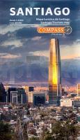
Stadtplan der Innenstadt von Santiago de Chile.

Map of Santiago, in Spanish and English, it contains the most important touristic area of the capital. It highlights the city’s main attractions, such as restaurants, cafes, museums and heritage neighborhoods. Printed in Stone Paper, mineral ecological paper that doesn’t require trees, water or chemicals to be produced. It is also waterproof, durable, recyclable and antiglare. The back contains a mini-guide that allows the tourist to get to know the highlights of San- tiago, with beautiful photographs and descriptions of the main neighborhoods.

Kartenausschnitt

Kartenbeispiel

Santiago de Chile - 1:8.000 Stadtplan
Mapa Turistico de Santiago Compass Chile
EAN / ISBN: 9789569248122
Preis: EUR 19.90

Dieser Titel ist momentan nicht lieferbar.
Produkt EUR Anzahl Bestellen
Santiago de Chile - 1:8.000 Stadtplan
Mapa Turistico de Santiago Compass Chile
19.90
Versandkostenfrei in Deutschland ab 30,- Bestellwert

incl. MwSt.

Stichworte, die bei der Suche nützlich sein könnten:
EditoresCompass - Chile - Santiago Stadtplan - Santiago de Chile - Chile - Chili - Chile Landkarten - Chile Trekkingkarten - Chile Reiseführer - Chilekarten - Mapas Chile - Mapas Compass - Chile Landkarten - Chile Regionalkarten - Editorial Compass - EditorialCompass - MapasCompass - Compass Chile - Chili - Chilenische Landkarten - Chilekarten - Anden - Südamerika

Zuletzt angesehene Artikel:

CoverSantiago de Chile - 1:8.000 Stadtplan
Mapa Turistico de Santiago Compass Chile

CoverCorfu Sunflower-Wanderführer - englisch - kostenlose Updates - car tours & walks

Cover01 Winterberg 1:25.000 Topographische Wanderkarte - GeoMap

CoverReno - Sparks Stadtplan 1:28.000 (Nevada - USA)
Reno / Sparks street map American Automobile Association

CoverFort Lauderdale Stadtplan - Rand McNally - USA

CoverLanzarote Straßenkarte Berndtson

CoverNorthern Suburbs Cape Town Street Map 1:29.000 Stadtplan Mapstudio Südafrika

CoverLitauen / Kaliningrad 1:325.000 Landkarte Reise-Know-How Verlag - world mapping project

CoverAchensee und Brandenberger Tal 50 Touren - Rother Wanderführer - Bergverlag Rother

CoverSterzing - Rund um - Wipptal: Vom Brenner bis Brixen 56 Touren - Rother Wanderführer - Bergverlag Rother

CoverReisehandbuch Hawaii - National Geographic Deutschland

CoverStuart / Okeechobee / Martin County & Vicinity Stadtplan 1:32.000 (Florida - USA)
Stuart / Okeechobee / Martin County & Vicinity street map GM Johnson

CoverCyprus Sunflower-Wanderführer - englisch - kostenlose Updates - car tours & walks

CoverIsrael - Jordanien Nelles-Reiseführer Nelles-Verlag

CoverPfälzerwald und Deutsche Weinstraße 50 Touren - Rother Wanderführer - Bergverlag Rother

CoverLimesweg Von Eining an der Donau nach Rheinbrohl am Rhein. 30 Etappen. Mit GPS-Daten - von Thorsten Lensing - Wanderführer Bergverlag Rother