 - mit Begleitheft (italienisch).  Übersicht der Titel ´ALTE VIE POCKET´ Übersicht der Titel ´ALTE VIE POCKET´
Blattschnitte Bologna Blattschnitte Alpen grenzüberschreitend Trient - Val d´Isère Blattschnitte Aosta-Tal - Piemonte Blattschnitte Maira-Tal und Umgebung - Piemonte Blattschnitte Apennin - Adria Kartenausschnitt
Kartenbeispiel
|
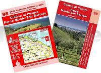
98 Colline di Pesaro - Parco Monte San Bartolo 1:25.000 / 1:15.000 (wasserfest) Topographische Wander- und Mountainbikekarte l`Escursionista Editore - Italien
Carta escursionistica e per mountain bike delle Colline di Pesaro e del Parco del Monte San Bartolo
EAN / ISBN: 9791280163127
Preis: EUR 15.90
|
| 


