Willkommen bei MapFox
+++ Buchhändleranfragen willkommen! Tel. 0431-666 75 99 +++
Warenkorb
Artikel: 0 - € 0.00
Zur Kasse
Impressum Kontakt Versandkosten AGB
609 Sagres (Vila do Bispo) Topographische Landkarte Portugal 1:25.000 Carta Militar de Portugal - Série M889 Instituto Geográfico do Exército (IGeoE) - Portugal
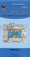
<< Portugal: Amtliche topografische Landkarten des Instituto Geográfico do Exército (IGeoE) 1:25.000
 

Gesamtliste mit Blattübersicht

Kartenbeispiel aus der Serie

Kartenausschnitt

609 Sagres (Vila do Bispo) Topographische Landkarte Portugal 1:25.000 Carta Militar de Portugal - Série M889 Instituto Geográfico do Exército (IGeoE) - Portugal
EAN / ISBN: 9789727906147
Preis: EUR 17.90

Bestellartikel: versandfertig in ca. 2 Wochen oder länger. Dieser Artikel wird speziell für Sie bestellt. Keine Rücknahme!
Produkt EUR Anzahl Bestellen
609 Sagres (Vila do Bispo) Topographische Landkarte Portugal 1:25.000 Carta Militar de Portugal - Série M889 Instituto Geográfico do Exército (IGeoE) - Portugal 17.90
Versandkostenfrei in Deutschland ab 20,- Bestellwert

incl. MwSt.

Stichworte, die bei der Suche nützlich sein könnten:
Sagres Landkarte - Sagres (Vila do Bispo) - Vila do Bispo Landkarte - Portugal - topografische Wanderkarten - Serie M888 - Série M888 - M888

Zuletzt angesehene Artikel:

Noch kein Cover vorhanden609 Sagres (Vila do Bispo) Topographische Landkarte Portugal 1:25.000 Carta Militar de Portugal - Série M889 Instituto Geográfico do Exército (IGeoE) - Portugal

CoverCC 7918 Stuttgart-Süd Topographische Übersichtskarte 1:200.000 - Bundesamt für Kartografie und Geodäsie und Landesvermessungsämter - ProjektNord

Cover2412-IV Korsør Topographische Karte Dänemark 1:50.000 - Kort & Matrikelstyrelsen ProjektNord

Cover2343 08+11 Muuras Topographische Karte 1:20.000 (Maastokartta / Peruskartta / Grundkarta) Maanmittauslaitos / Lantmäteriverket Finnland - ProjektNord

Noch kein Cover vorhanden4854 Löbau-Reichenbach (56) - Geologische Karte 1:25.000 (GK25) Grundlage Vollbornsche Äquidistantenkarte Sächsisches Landesamt für Umwelt, Landwirtschaft und Geologie

Cover4549 Schwarzheide/N.L. Topographische Karte 1:25.000 Landesvermessungsamt Brandenburg (gefaltet)

CoverMontana Atlas & Gazetteer - Topographischer Straßenatlas Delorme Publishing Company DELORME MAPPING USA

Cover31 Oberbergisches Talsperrenland 1:25.000 Topographische Wanderkarte - GeoMap

Cover444 Helmsdale & Strath of Kildonan - Wanderkarte Großbritannien 1:25.000 EXPLORER MAP - Active Map LAMINIERT - Ordnance Survey

CoverBaltikum 1:800.000 Autokarte
Baltia Karttakeskus / Genimap

CoverKaokoland 1:620.000 and Bushmanland 1:470.000 Landkarte Northern Namibia - InfoMap

CoverResidenzstadt Gotha 1730 - Historische Landkarte Nachdruck Planokarte - gerollt von Seutter, Matthäus - Verlag Rockstuhl

CoverDique Cabra Corral 1:100.000 / 1:174.000 Touristische Landkarte - Asiru Editorial - Argentinien

Noch kein Cover vorhanden443.2 Amtliche topographische Karte 1:50.000 Polen

Cover3943 Treuenbrietzen Sonderausgabe mit Wanderwegen - Topographische Wanderkarte Brandenburg 1:25.000 ProjektNord

Noch kein Cover vorhanden1533 Burg auf Fehmarn - Gestern und Heute - Historische Überlagerung 1932-1950 Topographische Landkarte 1:25.000 im Vergleich - Landesvermessungsamt Schleswig-Holstein / ProjektNord

CoverRom Pocket-Stadtplan-Atlas Touring Editore
Roma - Rome - pianta della citta Touring-Club Italiano (TCI) Italien

Cover4547 Elsterwerda Sonderausgabe mit Wanderwegen - Topographische Wanderkarte Brandenburg 1:25.000 ProjektNord

CoverWalking The Pennine Way - Route Map Booklet 1:25.000 Cicerone Großbritannien (englisch)

Noch kein Cover vorhandenRadReiseFührer Fünf-Flüsse-Radweg 6930 Radvergnügen entlang von Naab, Vils, Pegnitz, Altmühl und Donau mit Extra-Tourenkarte, Reiseführer und exakter Streckenbeschreibung - KOMPASS-Karten