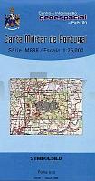
| << Portugal: Amtliche topografische Landkarten des Instituto Geográfico do Exército (IGeoE) 1:25.000 (Serie M888) |
||
|
||

Zuletzt angesehene Artikel:
 | 590 Alcarias (Alcoutim) Topographische Landkarte Portugal 1:25.000 Carta Militar de Portugal - Série M888 Instituto Geográfico do Exército (IGeoE) - Portugal |
 | 5808 Cochem - Wanderkarte mit Wanderwegen (geplottete Ausgabe) ProjektNord - Grundlage Amtliche topographische Karte Landesamt für Vermessung und Geobasisinformation Rheinland-Pfalz |
 | 5242 Stollberg Geologische Karte GK25 (N) Landesamtes für Umwelt, Landwirtschaft und Geologie Sachsen |
 | 522 Topographische Landkarte Wanderkarte und Fahrradkarte Portugal 1:25.000 522 Mapa topográfico - Mapa de caminhadas - Portugal 1:25.000 ProjektNord |
 | 59 Topographische Landkarte Wanderkarte und Fahrradkarte Portugal 1:25.000 059 Mapa topográfico - Mapa de caminhadas - Portugal 1:25.000 ProjektNord |
 | 5321 (NM 33-12-21) Gänserndorf Topographische Wanderkarte 1:50.000 mit Wegmarkierungen - Ãsterreich - Kartographie BEV - ProjektNord |
 | 5310 Asbach - Wanderkarte mit Wanderwegen (geplottete Ausgabe) ProjektNord - Grundlage Amtliche topographische Karte Landesamt für Vermessung und Geobasisinformation Rheinland-Pfalz |
 | 523 - Topographische Landkarte Portugal 1:25.000 Carta Militar de Portugal - Série M888 Instituto Geográfico do Exército (IGeoE) - Portugal |
 | 500 Topographische Landkarte Wanderkarte und Fahrradkarte Portugal 1:25.000 500 Mapa topográfico - Mapa de caminhadas - Portugal 1:25.000 ProjektNord |