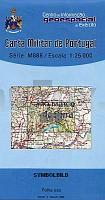
| << Portugal: Amtliche topografische Landkarten des Instituto Geográfico do Exército (IGeoE) 1:25.000 (Serie M888) |
  | |
|
||
Zuletzt angesehene Artikel:
![]() | 578 Sao Marcos da Serra (Silves) Topographische Landkarte Portugal 1:25.000 Carta Militar de Portugal - Série M888 Instituto Geográfico do Exército (IGeoE) - Portugal |
![]() | Estland West 1:275.000 - Touristische Landkarte Hiiumaa - Saaremaa - Läänemaa Lääne-Eesti turismikaart / West Estonia tourist map. Hiiumaa - Saaremaa - Läänemaa REGIO Estland |
![]() | 590 Alcarias (Alcoutim) Topographische Landkarte Portugal 1:25.000 Carta Militar de Portugal - Série M888 Instituto Geográfico do Exército (IGeoE) - Portugal |
![]() | 25M SV KALIX 1:50.000 *** SCHNÄPPCHEN *** Topographische Wanderkarte Schweden (Terrängkarta/Gröna Kartan) - Kartförlaget - Lantmäteriet Landkarte Schweden |
![]() | 1831 Grömitz - Gestern und Heute - Historische Überlagerung 1902-1930 Topographische Landkarte 1:25.000 im Vergleich - Landesvermessungsamt Schleswig-Holstein / ProjektNord |
![]() | 44 Ruivaes (Vieira do Minho) - Topographische Landkarte Portugal 1:25.000 Carta Militar de Portugal - Série M888 Instituto Geográfico do Exército (IGeoE) - Portugal |
![]() | 2029 Stockelsdorf - Gestern und Heute - Historische Überlagerung 1902-1930 Topographische Landkarte 1:25.000 im Vergleich - Landesvermessungsamt Schleswig-Holstein / ProjektNord |
![]() | 181-1 MONTARDO *** SCHNÄPPCHEN *** Amtliche topographische Landkarte 1:25.000 Spanien (M.T.N.) 181-1 Mapa Topográfico Nacional de Espana (MTN25) Instituto Geográfico Nacional - CNIG Spanien |
![]() | Schweden / Norwegen: Nordseeküstenradweg OutdoorHandbuch - Der Weg ist das Ziel (Band 228) -von Idhuna Barelds, Wolfgang Barelds-Conrad-Stein-Verlag |
![]() | Pilis + Visegrád-Berge - Topografische Wanderkarte Ungarn 1:40.000 / 1:25.000 (TT16) Pilis és Visegrádi-hegység turistatérkép (TT16) - Cartographia |
![]() | 1324 Süderbrarup - Gestern und Heute - Historische Überlagerung 1878-1880 Topographische Landkarte 1:25.000 im Vergleich - Landesvermessungsamt Schleswig-Holstein / ProjektNord |
![]() | BÖRZSÖNY 4in1 tourist and cycling map & guide (water- and tear resistant) 1:40.000 - Cartographia Ungarn Börzsöny, Ipoly, Naszály - outdoor kalauz |


