| << Portugal: Amtliche topografische Landkarten des Instituto Geográfico do Exército (IGeoE) 1:25.000 (Serie M888) |
||
|
||

Zuletzt angesehene Artikel:
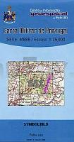
 | 551 - Topographische Landkarte Portugal 1:25.000 Carta Militar de Portugal - Série M888 Instituto Geográfico do Exército (IGeoE) - Portugal |
 | 5822 Wiesen - Wanderkarte mit Wanderwegen (geplottete Ausgabe) Topographische Landkarte Hessen 1:25.000 - ProjektNord (geplottete Ausgabe) |
 | 503 (13-20) Las Veguillas Amtliche topographische Landkarte 1:50.000 Spanien (M.T.N.) 503 Mapa Topográfico Nacional de Espana (MTN50) Instituto Geográfico Nacional - CNIG Spanien |
 | 510 - Topographische Landkarte Portugal 1:25.000 Carta Militar de Portugal - Série M888 Instituto Geográfico do Exército (IGeoE) - Portugal |
 | 572 Valverde del Fresno Amtliche topographische Landkarte 1:50.000 Spanien (M.T.N.) 572 Mapa Topográfico Nacional de Espana (MTN50) Instituto Geográfico Nacional - CNIG Spanien |
 | 541 - Topographische Landkarte Portugal 1:25.000 Carta Militar de Portugal - Série M888 Instituto Geográfico do Exército (IGeoE) - Portugal |
 | 503 Topographische Landkarte Wanderkarte und Fahrradkarte Portugal 1:25.000 503 Mapa topográfico - Mapa de caminhadas - Portugal 1:25.000 ProjektNord |
 | 5218 Niederwalgern - Wanderkarte mit Wanderwegen (geplottete Ausgabe) Topographische Landkarte Hessen 1:25.000 - ProjektNord (geplottete Ausgabe) |
 | 520 Topographische Landkarte Wanderkarte und Fahrradkarte Portugal 1:25.000 520 Mapa topográfico - Mapa de caminhadas - Portugal 1:25.000 ProjektNord |
 | 534 - Topographische Landkarte Portugal 1:25.000 Carta Militar de Portugal - Série M888 Instituto Geográfico do Exército (IGeoE) - Portugal |
 | 583 Arganda del Rey Amtliche topographische Landkarte 1:50.000 Spanien (M.T.N.) 583 Mapa Topográfico Nacional de Espana (MTN50) Instituto Geográfico Nacional - CNIG Spanien |
 | 597 Montehermoso Amtliche topographische Landkarte 1:50.000 Spanien (M.T.N.) 597 Mapa Topográfico Nacional de Espana (MTN50) Instituto Geográfico Nacional - CNIG Spanien |
 | 558 Mértola Topographische Landkarte Wanderkarte und Fahrradkarte Portugal 1:25.000 558 Mapa topográfico - Mapa de caminhadas - Portugal 1:25.000 ProjektNord |
 | 508 Topographische Landkarte Wanderkarte und Fahrradkarte Portugal 1:25.000 508 Mapa topográfico - Mapa de caminhadas - Portugal 1:25.000 ProjektNord |
 | 5710 Münstermaifeld - Wanderkarte mit Wanderwegen (geplottete Ausgabe) ProjektNord - Grundlage Amtliche topographische Karte Landesamt für Vermessung und Geobasisinformation Rheinland-Pfalz |
 | 589 Terriente Amtliche topographische Landkarte 1:50.000 Spanien (M.T.N.) 589 Mapa Topográfico Nacional de Espana (MTN50) Instituto Geográfico Nacional - CNIG Spanien |
 | 515 - Topographische Landkarte Portugal 1:25.000 Carta Militar de Portugal - Série M888 Instituto Geográfico do Exército (IGeoE) - Portugal |
 | 5622 Steinau - Wanderkarte mit Wanderwegen (geplottete Ausgabe) Topographische Landkarte Hessen 1:25.000 - ProjektNord (geplottete Ausgabe) |
 | 5915 Wiesbaden - Wanderkarte mit Wanderwegen (geplottete Ausgabe) Topographische Landkarte Hessen 1:25.000 - ProjektNord (geplottete Ausgabe) |
 | 591 Mora de Rubielos Amtliche topographische Landkarte 1:50.000 Spanien (M.T.N.) 591 Mapa Topográfico Nacional de Espana (MTN50) Instituto Geográfico Nacional - CNIG Spanien |