| << Portugal: Amtliche topografische Landkarten des Instituto Geográfico do Exército (IGeoE) 1:25.000 (Serie M888) |
||
|
||

Zuletzt angesehene Artikel:
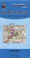
 | 515 - Topographische Landkarte Portugal 1:25.000 Carta Militar de Portugal - Série M888 Instituto Geográfico do Exército (IGeoE) - Portugal |
 | 5622 Steinau - Wanderkarte mit Wanderwegen (geplottete Ausgabe) Topographische Landkarte Hessen 1:25.000 - ProjektNord (geplottete Ausgabe) |
 | 5915 Wiesbaden - Wanderkarte mit Wanderwegen (geplottete Ausgabe) Topographische Landkarte Hessen 1:25.000 - ProjektNord (geplottete Ausgabe) |
 | 591 Mora de Rubielos Amtliche topographische Landkarte 1:50.000 Spanien (M.T.N.) 591 Mapa Topográfico Nacional de Espana (MTN50) Instituto Geográfico Nacional - CNIG Spanien |
 | 5219 Amöneburg - Wanderkarte mit Wanderwegen (geplottete Ausgabe) Topographische Landkarte Hessen 1:25.000 - ProjektNord (geplottete Ausgabe) |
 | 577 Amtliche topographische Landkarte 1:50.000 Spanien (M.T.N.) 577 Mapa Topográfico Nacional de Espana (MTN50) Instituto Geográfico Nacional - CNIG Spanien |
 | 5511 Bendorf - Wanderkarte mit Wanderwegen (geplottete Ausgabe) ProjektNord - Grundlage Amtliche topographische Karte Landesamt für Vermessung und Geobasisinformation Rheinland-Pfalz |
 | 501 La Fuente de San Esteban Amtliche topographische Landkarte 1:50.000 Spanien (M.T.N.) 501 Mapa Topográfico Nacional de Espana (MTN50) Instituto Geográfico Nacional - CNIG Spanien |
 | 533 Topographische Landkarte Wanderkarte und Fahrradkarte Portugal 1:25.000 533 Mapa topográfico - Mapa de caminhadas - Portugal 1:25.000 ProjektNord |
 | 525 - Topographische Landkarte Portugal 1:25.000 Carta Militar de Portugal - Série M888 Instituto Geográfico do Exército (IGeoE) - Portugal |
 | 564 - Topographische Landkarte Portugal 1:25.000 Carta Militar de Portugal - Série M888 Instituto Geográfico do Exército (IGeoE) - Portugal |
 | 5031 Mariazell - Ãtscher - Josefsberg - Annaberg - Erlaufsee 1:35.000 *** SCHNÃPPCHEN *** - Wanderkarte / Radwanderkarte / Wintersportkarte Ãsterreich - GPS - Freytag & Berndt |
 | 585 Almonacid de Zorita Amtliche topographische Landkarte 1:50.000 Spanien (M.T.N.) 585 Mapa Topográfico Nacional de Espana (MTN50) Instituto Geográfico Nacional - CNIG Spanien |
 | 5224 Eiterfeld - Wanderkarte mit Wanderwegen (geplottete Ausgabe) Topographische Landkarte Hessen 1:25.000 - ProjektNord (geplottete Ausgabe) |
 | 510 Marchamalo Amtliche topographische Landkarte 1:50.000 Spanien (M.T.N.) 510 Mapa Topográfico Nacional de Espana (MTN50) Instituto Geográfico Nacional - CNIG Spanien |
 | 563 Priego Amtliche topographische Landkarte 1:50.000 Spanien (M.T.N.) 563 Mapa Topográfico Nacional de Espana (MTN50) Instituto Geográfico Nacional - CNIG Spanien |
 | 544 Forcall Amtliche topographische Landkarte 1:50.000 Spanien (M.T.N.) 544 Mapa Topográfico Nacional de Espana (MTN50) Instituto Geográfico Nacional - CNIG Spanien |
 | 5221 Alsfeld - Wanderkarte mit Wanderwegen (geplottete Ausgabe) Topographische Landkarte Hessen 1:25.000 - ProjektNord (geplottete Ausgabe) |
 | 54 - Topographische Landkarte Portugal 1:25.000 Carta Militar de Portugal - Série M888 Instituto Geográfico do Exército (IGeoE) - Portugal |
 | 541 Santa Eulalia Amtliche topographische Landkarte 1:50.000 Spanien (M.T.N.) 541 Mapa Topográfico Nacional de Espana (MTN50) Instituto Geográfico Nacional - CNIG Spanien |