| << Portugal: Amtliche topografische Landkarten des Instituto Geográfico do Exército (IGeoE) 1:25.000 (Serie M888) |
||
|
||

Zuletzt angesehene Artikel:
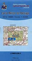
 | 496 - Topographische Landkarte Portugal 1:25.000 Carta Militar de Portugal - Série M888 Instituto Geográfico do Exército (IGeoE) - Portugal |
 | 4244-SO Topographische Karte 1:10.000 - Landesvermessungsamt Brandenburg |
 | 4211 (NL 33-02-11) Neuberg an der Mürz Topographische Wanderkarte 1:50.000 mit Wegmarkierungen - Ãsterreich - Kartographie BEV - ProjektNord |
 | 417 - Topographische Landkarte Portugal 1:25.000 Carta Militar de Portugal - Série M888 Instituto Geográfico do Exército (IGeoE) - Portugal |
 | 450 - Topographische Landkarte Portugal 1:25.000 Carta Militar de Portugal - Série M888 Instituto Geográfico do Exército (IGeoE) - Portugal |
 | 456 - Topographische Landkarte Portugal 1:25.000 Carta Militar de Portugal - Série M888 Instituto Geográfico do Exército (IGeoE) - Portugal |
 | 449 Topographische Landkarte Wanderkarte und Fahrradkarte Portugal 1:25.000 449 Mapa topográfico - Mapa de caminhadas - Portugal 1:25.000 ProjektNord |
 | 403 Topographische Landkarte Wanderkarte und Fahrradkarte Portugal 1:25.000 403 Mapa topográfico - Mapa de caminhadas - Portugal 1:25.000 ProjektNord |
 | 455 Topographische Landkarte Wanderkarte und Fahrradkarte Portugal 1:25.000 455 Mapa topográfico - Mapa de caminhadas - Portugal 1:25.000 ProjektNord |
 | 479 - Topographische Landkarte Portugal 1:25.000 Carta Militar de Portugal - Série M888 Instituto Geográfico do Exército (IGeoE) - Portugal |
 | 4920 Armsfeld - Wanderkarte mit Wanderwegen (geplottete Ausgabe) Topographische Landkarte Hessen 1:25.000 - ProjektNord (geplottete Ausgabe) |
 | 4926 Herleshausen - Wanderkarte mit Wanderwegen (geplottete Ausgabe) Topographische Landkarte Hessen 1:25.000 - ProjektNord (geplottete Ausgabe) |
| 4348-NW Topographische Karte 1:10.000 - Landesvermessungsamt Brandenburg |
 | 4422 Trendelburg - Wanderkarte mit Wanderwegen (geplottete Ausgabe) Topographische Landkarte Hessen 1:25.000 - ProjektNord (geplottete Ausgabe) |
 | 4144 Linda Sonderausgabe mit Wanderwegen - Topographische Wanderkarte Brandenburg 1:25.000 ProjektNord |
 | 4925 Sontra - Wanderkarte mit Wanderwegen (geplottete Ausgabe) Topographische Landkarte Hessen 1:25.000 - ProjektNord (geplottete Ausgabe) |
| 4049-SO Topographische Karte 1:10.000 - Landesvermessungsamt Brandenburg |
 | 472 - Topographische Landkarte Portugal 1:25.000 Carta Militar de Portugal - Série M888 Instituto Geográfico do Exército (IGeoE) - Portugal |
| 4246-SO Topographische Karte 1:10.000 - Landesvermessungsamt Brandenburg |
 | Würselen - Herzogenrath *** SCHNÃPPCHEN *** Stadtplan Blees-Verlag |