Willkommen bei MapFox
+++ Buchhändleranfragen willkommen! Tel. 0431-666 75 99 +++
Warenkorb
Artikel: 0 - € 0.00
Zur Kasse
Impressum Kontakt Versandkosten AGB
465 - Topographische Landkarte Portugal 1:25.000 Carta Militar de Portugal - Série M889 Instituto Geográfico do Exército (IGeoE) - Portugal
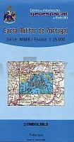
<< Portugal: Amtliche topografische Landkarten des Instituto Geográfico do Exército (IGeoE) 1:25.000
 

Gesamtliste mit Blattübersicht

Kartenbeispiel aus der Serie

465 - Topographische Landkarte Portugal 1:25.000 Carta Militar de Portugal - Série M889 Instituto Geográfico do Exército (IGeoE) - Portugal
Preis: EUR 17.90

Bestellartikel: versandfertig in ca. 2 Wochen oder länger. Dieser Artikel wird speziell für Sie bestellt. Keine Rücknahme!
Produkt EUR Anzahl Bestellen
465 - Topographische Landkarte Portugal 1:25.000 Carta Militar de Portugal - Série M889 Instituto Geográfico do Exército (IGeoE) - Portugal 17.90
Versandkostenfrei in Deutschland ab 20,- Bestellwert

incl. MwSt.

Stichworte, die bei der Suche nützlich sein könnten:
Portugal - topografische Wanderkarten - Serie M888 - Série M888 - M888

Zuletzt angesehene Artikel:

Noch kein Cover vorhanden465 - Topographische Landkarte Portugal 1:25.000 Carta Militar de Portugal - Série M889 Instituto Geográfico do Exército (IGeoE) - Portugal

Cover3934 03+06 Tsuomasvarri Topographische Karte 1:20.000 (Maastokartta / Peruskartta / Grundkarta) Maanmittauslaitos / Lantmäteriverket Finnland - ProjektNord

Noch kein Cover vorhanden4545-SO Topographische Karte 1:10.000 - Landesvermessungsamt Brandenburg

Cover6023 Lohr am Main Topographische Landkarte Bayern 1:25.000 - Normalausgabe - ProjektNord (geplottete Ausgabe) - Grundlage amtliche Topographische Karte Bayern DTK25

Cover2314-IV Aarhus - mit Wanderwegen und Fahrradrouten Topographische Fahrradkarte und Wanderkarte Dänemark 1:50.000 - Kort & Matrikelstyrelsen ProjektNord
2314-IV Aarhus - Topografisk Cykel- og Vandrekort Danmark

CoverNL 33-01-09 (3209) Bad Reichenhall Österreichische Karte 1:50.000 mit Wegmarkierungen (topographische Wanderkarte - UTM) - BEV - Österreich

Cover3422 07 Laitasaaari Topographische Karte 1:20.000 (Maastokartta / Peruskartta / Grundkarta) Maanmittauslaitos / Lantmäteriverket Finnland - ProjektNord

Cover149 Chvojnicka pahorkatina - Skalica Wanderkarte Slowakei 1:50.000 - VKU

Cover3744 06 Kuikkapää Topographische Karte 1:20.000 (Maastokartta / Peruskartta / Grundkarta) Maanmittauslaitos / Lantmäteriverket Finnland - ProjektNord

CoverFinnland Mit Helsinki, Turku, Ostsee, Schären, Seenplatte und Lappland - von Rasso Knoller - TRESCHER

CoverZlin - Otrokowitz 1:15.000 und Umgebung 1:100.000 Stadtplan
Zlin - Otrokovice / Okoli Zlína SHOCart Freytag & Berndt

Noch kein Cover vorhanden4645-NO Topographische Karte 1:10.000 - Landesvermessungsamt Brandenburg

Cover4611 11 Virranniemi Topographische Karte 1:20.000 (Maastokartta / Peruskartta / Grundkarta) Maanmittauslaitos / Lantmäteriverket Finnland - ProjektNord

Cover2513 Zetel Amtliche topographische Karte 1:25.000 Landesvermessungsamt Niedersachsen

Cover15/5-6 ST NIKLAAS NGI 1:25.000 Topographische Landkarte Belgien

Cover3212 Löningen Amtliche topographische Karte 1:25.000 Landesvermessungsamt Niedersachsen

Noch kein Cover vorhandenThe English Alphabet Software Englisch - Stiefel EUROCART

CoverBad Sachsa 1:25.000 Stadtplan + Wanderkarte Harz KKV - Kartographische Kommunale Verlagsgesellschaft

Cover2213-IV-SV Topographische Karte Dänemark 1:25.000
Topografisk kort Danmark (DTK/Kort25) 2213-IV-SV ProjektNord - Kort & Matrikelstyrelsen / Geodætisk Institut

Noch kein Cover vorhanden2883 08 Tilicho (53) 1:50.000 Annapurna Trek FINN MAPS - HMG Nepal