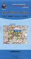
| << Portugal: Amtliche topografische Landkarten des Instituto Geográfico do Exército (IGeoE) 1:25.000 |
  | |
|
||
Zuletzt angesehene Artikel:
![]() | 447 - Topographische Landkarte Portugal 1:25.000 Carta Militar de Portugal - Série M889 Instituto Geográfico do Exército (IGeoE) - Portugal |
![]() | Kreis Saybusch Wanderkarte 60.000 Polen Powiat Żywiecki Compass - Polen |
![]() | NL 33-05-12 Ost (4112-Ost) Bad Radkersburg Österreichische Karte 1:25.000 mit Wegmarkierungen (topographische Wanderkarte - UTM) - BEV - Österreich - Vergrößerung (ÖK25V) |
![]() | 3242 04 Kutunkylä Topographische Karte 1:20.000 (Maastokartta / Peruskartta / Grundkarta) Maanmittauslaitos / Lantmäteriverket Finnland - ProjektNord |
![]() | Haarlem - Stadtplan 1:20.000 Haarlem Stadsplattegrond freytag & berndt |
![]() | 361 Cervera Amtliche topographische Landkarte 1:50.000 Spanien (M.T.N.) 361 Mapa Topográfico Nacional de Espana (MTN50) Instituto Geográfico Nacional - CNIG Spanien |
![]() | Lychen - Fürstenberg/Havel - Radwanderkarte - Wanderkarte - Paddelkarte (Blatt 141) Klemmer-Pocket, 1:50.000, GPS geeignet, Freizeit-Tipps auf der Rückseite Klemmer-Verlag |
![]() | 189 Ashford & Romney Marsh - Rye & Folkestone - Wanderkarte Großbritannien 1:50.000 LANDRANGER MAP - Ordnance Survey |
![]() | Mumbai (Bombay) Street Atlas 1:12.500 - Straßenatlas Indien - Eicher Goodearth Private Limited |
![]() | 248S PRÄTTIGAU - St.Antönien - Arosa - Davos 1:50.000 Topographische Skitourenkarte SSV der Schweiz - swisstopo |
![]() | 7 Badajoz Landkarte 1:200.000 Spanien - Provinzkarte - CNIG Badajoz - Mapa Provincial Centro Nacional de Información Geográfico |
![]() | Mountain Biking on the South Downs Radwanderführer Cicerone Großbritannien (englisch) |
![]() | N-33-103/104 Choszczno (Arnswalde) Plot aus der Kartengrundlage der amtliche topographische Karte Polen 1:100.000 ProjektNord |
![]() | BF36 Atiamuri Topographische Landkarte Neuseeland 1:50.000 Land Information New Zealand |
![]() | 2712 Apen Amtliche topographische Karte 1:25.000 Landesvermessungsamt Niedersachsen |
![]() | 25N HAPARANDA 1:100.000 *** SCHNÄPPCHEN *** Wegekarte Schweden (Vägkarta/Blå Kartan) - Kartförlaget - Lantmäteriet Landkarte Schweden |
![]() | 3123 01 Paaso Topographische Karte 1:20.000 (Maastokartta / Peruskartta / Grundkarta) Maanmittauslaitos / Lantmäteriverket Finnland - ProjektNord |
![]() | The Great Himalaya Trail 1864 Kilometer Trailrunning durch eine bedrohte Welt in Nepal - von Hinze, Peter (Verfasser, Fotograf) - Knesebeck |


