
| << Portugal: Amtliche topografische Landkarten des Instituto Geográfico do Exército (IGeoE) 1:25.000 (Serie M888) |
||
|
||


Zuletzt angesehene Artikel:
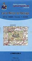
 | 423 - Topographische Landkarte Portugal 1:25.000 Carta Militar de Portugal - Série M888 Instituto Geográfico do Exército (IGeoE) - Portugal |
 | 0815 ROBLEDO Topographische Landkarte 1:50.000 Spanien (Grundlage MTN50) Instituto Geográfico Nacional - CNIG Spanien - ProjektNord |
 | 0665 MIRA Topographische Landkarte 1:50.000 Spanien (Grundlage MTN50) Instituto Geográfico Nacional - CNIG Spanien - ProjektNord |
 | 2512-II Nyord - mit Wanderwegen und Fahrradrouten Topographische Fahrradkarte und Wanderkarte Dänemark 1:50.000 - Kort & Matrikelstyrelsen ProjektNord 2512-II Nyord - Topografisk Cykel- og Vandrekort Danmark |
 | 0176-4 JACA Topographische Landkarte 1:25.000 Spanien (Grundlage MTN25) Instituto Geográfico Nacional - CNIG Spanien - ProjektNord |
 | 0489-2 TORRUBIA Topographische Landkarte 1:25.000 Spanien (Grundlage MTN25) Instituto Geográfico Nacional - CNIG Spanien - ProjektNord |
 | 5 Umgebung von Tilsit - Karte des Deutschen Reiches 1:100.000 (KDR 100 GB) - Großblatt Reichsamt für Landesaufnahme / Preußische Landesaufnahme ProjektNord |
 | 941-2 EMBALSE DEL HUESNA Amtliche topographische Landkarte 1:25.000 Spanien (M.T.N.) 941-2 Mapa Topográfico Nacional de Espana (MTN25) Instituto Geográfico Nacional - CNIG Spanien |
 | 292 SANT LLORENÇ DE MORUNYS Amtliche topographische Landkarte 1:50.000 Spanien (M.T.N.) 292 Mapa Topográfico Nacional de Espana (MTN50) Instituto Geográfico Nacional - CNIG Spanien |
 | 0509-2 TORRELAGUNA Topographische Landkarte 1:25.000 Spanien (Grundlage MTN25) Instituto Geográfico Nacional - CNIG Spanien - ProjektNord |
 | 0699-3 ALGAIDA Topographische Landkarte 1:25.000 Spanien (Grundlage MTN25) Instituto Geográfico Nacional - CNIG Spanien - ProjektNord |
 | 3245-NO Topographische Karte 1:10.000 - Landesvermessungsamt Brandenburg |
 | 0068-3 DUMBRÍA Topographische Landkarte 1:25.000 Spanien (Grundlage MTN25) Instituto Geográfico Nacional - CNIG Spanien - ProjektNord |
 | 1082 ARRECIFE Topographische Landkarte 1:50.000 Spanien (Grundlage MTN50) Instituto Geográfico Nacional - CNIG Spanien - ProjektNord |
 | 0740-1 SOCUÉLLAMOS Topographische Landkarte 1:25.000 Spanien (Grundlage MTN25) Instituto Geográfico Nacional - CNIG Spanien - ProjektNord |
 | 0078-4 CASOMERA Topographische Landkarte 1:25.000 Spanien (Grundlage MTN25) Instituto Geográfico Nacional - CNIG Spanien - ProjektNord |
 | 2011 14 HISSKÄRET Topographische Karte 1:20.000 (Maastokartta / Peruskartta / Grundkarta) Maanmittauslaitos / Lantmäteriverket Finnland - ProjektNord |
 | 0537 AUÑÓN Topographische Landkarte 1:50.000 Spanien (Grundlage MTN50) Instituto Geográfico Nacional - CNIG Spanien - ProjektNord |
 | 11 Mofreita (Vinhais) Topographische Landkarte Wanderkarte und Fahrradkarte Portugal 1:25.000 011 Mapa topográfico - Mapa de caminhadas - Portugal 1:25.000 ProjektNord |
 | 3033 Woltersdorf Topographische Wanderkarte 1:25.000 Niedersachsen mit Wanderwegen - ProjektNord |