| << Portugal: Amtliche topografische Landkarten des Instituto Geográfico do Exército (IGeoE) 1:25.000 |
  | |
|
||
Zuletzt angesehene Artikel:
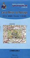
![]() | 421 - Topographische Landkarte Portugal 1:25.000 Carta Militar de Portugal - Série M889 Instituto Geográfico do Exército (IGeoE) - Portugal |
![]() | 15 Velas (S. Jorge - Azoren) - Topografische Karte Portugal 1:25.000 Carta Militar de Portugal - Série M889 - 1/25 000 (Acores) - Instituto Geográfico do Exército (IGeoE) - Portugal |
![]() | 209 Sørvágur Färöer - Topographische Karte 1:20.000 209 Færøer - Topografisk kort 1:20.000 - Miliøministeriet - Kort & Matrikelstyrelsen / ProjektNord |
![]() | 3421 Husum Topographische Wanderkarte 1:25.000 Niedersachsen mit Wanderwegen - ProjektNord |
![]() | 7939 Wasserburg am Inn Topographische Landkarte Bayern 1:25.000 - Normalausgabe - ProjektNord (geplottete Ausgabe) - Grundlage amtliche Topographische Karte Bayern DTK25 |
![]() | The South Downs Way - Map Booklet 1:25.000 - Southern England - Cicerone Großbritannien (englisch) |
![]() | 6310 Baumholder - Wanderkarte mit Wanderwegen (geplottete Ausgabe) ProjektNord - Grundlage Amtliche topographische Karte Landesamt für Vermessung und Geobasisinformation Rheinland-Pfalz |
![]() | 682 Sevilleja de la Jara Amtliche topographische Landkarte 1:50.000 Spanien (M.T.N.) 682 Mapa Topográfico Nacional de Espana (MTN50) Instituto Geográfico Nacional - CNIG Spanien |
![]() | 2113 05 Latovainio Topographische Karte 1:20.000 (Maastokartta / Peruskartta / Grundkarta) Maanmittauslaitos / Lantmäteriverket Finnland - ProjektNord |
![]() | 3711 10 Syväjärvi Topographische Karte 1:20.000 (Maastokartta / Peruskartta / Grundkarta) Maanmittauslaitos / Lantmäteriverket Finnland - ProjektNord |
![]() | 1370 Glowitz Topographische Karte 1:25.000 Messtischblatt des Deutschen Reiches - Preußische Landesaufnahme / Reichsamt für Landesaufnahme - Faksimile ProjektNord |
![]() | 4311 09 Kajoonjärvi Topographische Karte 1:20.000 (Maastokartta / Peruskartta / Grundkarta) Maanmittauslaitos / Lantmäteriverket Finnland - ProjektNord |
![]() | Die schönsten Wanderungen auf Kreta (englisch) von Michele Buonsanti - Alberta Galla The most beautiful excursions in Crete - by Michele Buonsanti - Alberta Galla Mystis - Griechenland |
![]() | 5072 Schwirz Topographische Karte 1:25.000 Messtischblatt des Deutschen Reiches - Preußische Landesaufnahme / Reichsamt für Landesaufnahme - Faksimile ProjektNord |
![]() | Grand Canyon East National Park - Arizona 1:90.000 (Blatt 262) wasserfest (engl.) National Geographic USA |
![]() | 7448 Untergriesbach Topographische Landkarte Bayern 1:25.000 - Normalausgabe - ProjektNord (geplottete Ausgabe) - Grundlage amtliche Topographische Karte Bayern DTK25 |
![]() | 1189 Powunden Topographische Karte 1:25.000 Messtischblatt des Deutschen Reiches - Preußische Landesaufnahme / Reichsamt für Landesaufnahme - Faksimile ProjektNord |
![]() | 2512 Næstved - Topografische Landkarte Dänemark 1:100.000 2512 Næstved - Danmark Topografisk kort 1:100.000 Kort & Matrikelstyrelsen |
![]() | Mountainbikepark Pfälzerwald (MBP) Topografische Wanderkarte u. Radwanderkarte 1:50.000 - Landesamt für Vermessung und Geobasisinformation Rheinland-Pfalz |
![]() | 39B WIJK BIJ DUURSTEDE Topographische Karte der Niederlande 1:25.000 (Plotausgabe) 39B WIJK BIJ DUURSTEDE Topografische Kaart van Nederland Kadaster - ProjektNord |


