| << Portugal: Amtliche topografische Landkarten des Instituto Geográfico do Exército (IGeoE) 1:25.000 (Serie M888) |
||
|
||

Zuletzt angesehene Artikel:
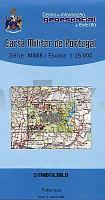
 | 380 - Topographische Landkarte Portugal 1:25.000 Carta Militar de Portugal - Série M888 Instituto Geográfico do Exército (IGeoE) - Portugal |
 | 3543-SO Topographische Karte 1:10.000 - Landesvermessungsamt Brandenburg |
 | 3111 07 Villikkala Topographische Karte 1:20.000 (Maastokartta / Peruskartta / Grundkarta) Maanmittauslaitos / Lantmäteriverket Finnland - ProjektNord |
 | W272 Leutkirch im Allgäu - Wanderkarte 1:25.000 Isny im Allgäu, Schwarzer Grat - von LGL - Landesamt für Geoinformation und Landentwicklung Baden-Württemberg (LGL) |
 | Arzachena *** SCHNÃPPCHEN *** Topographische Wanderkarte Sardinien 1:30.000 (deu./engl./frz./ital.) Carta turistico-escursionistica di Arzachena Edizioni Abies |
 | Arnstadt 1:10.000 / 1:50.000 Stadtplan + Wanderkarte Thüringen KKV - Kartographische Kommunale Verlagsgesellschaft |
| 541.42 Bielsko-Biala-Leszczyny Amtliche topographische Karte 1:25.000 Polen |
 | 55 Carapecos Topographische Landkarte Wanderkarte und Fahrradkarte Portugal 1:25.000 055 Mapa topográfico - Mapa de caminhadas - Portugal 1:25.000 ProjektNord |
 | Cuba Slang - Wort für Wort Kauderwelsch-Sprachführer (Band 175) Kuba - Reise-Know-How Verlag |
| 1685 Braunsberg (Ost) Topographische Karte 1:25.000 Messtischblatt des Deutschen Reiches - PreuÃische Landesaufnahme / Reichsamt für Landesaufnahme - Faksimile ProjektNord |
 | W249 Villingen-Schwenningen Baar - Rottweil - Schramberg - Wanderkarte 1:25.000 - Schwäbischer Albverein |
| 5143 Chemnitz (96) - Geologische Karte 1:25.000 (GK25) Grundlage Vollbornsche Ãquidistantenkarte Sächsisches Landesamt für Umwelt, Landwirtschaft und Geologie |
| BJ43pt Topographische Landkarte Neuseeland 1:50.000 Land Information New Zealand |
 | 3644 05 Vuotostunturi Topographische Karte 1:20.000 (Maastokartta / Peruskartta / Grundkarta) Maanmittauslaitos / Lantmäteriverket Finnland - ProjektNord |
 | 3223 11 Pieni-Myhi Topographische Karte 1:20.000 (Maastokartta / Peruskartta / Grundkarta) Maanmittauslaitos / Lantmäteriverket Finnland - ProjektNord |
| 3557 Schermeisel Topographische Karte 1:25.000 Messtischblatt des Deutschen Reiches - PreuÃische Landesaufnahme / Reichsamt für Landesaufnahme - Faksimile ProjektNord |
 | 235 Covilhã Topographische Landkarte Wanderkarte und Fahrradkarte Portugal 1:25.000 235 Mapa topográfico - Mapa de caminhadas - Portugal 1:25.000 ProjektNord |
 | 2513-IV Roskilde - mit Wanderwegen und Fahrradrouten Topographische Fahrradkarte und Wanderkarte Dänemark 1:50.000 - Kort & Matrikelstyrelsen ProjektNord 2513-IV Roskilde - Topografisk Cykel- og Vandrekort Danmark |
 | 3232 06 Kukkaromäki Topographische Karte 1:20.000 (Maastokartta / Peruskartta / Grundkarta) Maanmittauslaitos / Lantmäteriverket Finnland - ProjektNord |
| 355.33 Amtliche topographische Karte 1:25.000 Polen |