| << Portugal: Amtliche topografische Landkarten des Instituto Geográfico do Exército (IGeoE) 1:25.000 (Serie M888) |
||
|
||

Zuletzt angesehene Artikel:
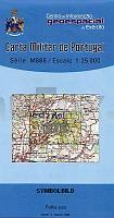
 | 375 - Topographische Landkarte Portugal 1:25.000 Carta Militar de Portugal - Série M888 Instituto Geográfico do Exército (IGeoE) - Portugal |
 | 3221 (NL 33-01-21) Zell am See Topographische Wanderkarte 1:50.000 mit Wegmarkierungen - Ãsterreich - Kartographie BEV - ProjektNord |
 | Parque Natural Torcal de Antequera y Lagunas Fuente de Piedra, Campillos, Ratosa y Archidona Topographische Wanderkarten 1:25:000 / 1:30.000 (englisch) Natural Reserves Laggons Fuente de Piedra, Campillos, Ratosa y Archidona - Natural Park Torcal of Antequera Editorial Penibética - Spanien |
 | 3352 Letschin Sonderausgabe mit Wanderwegen - Topographische Wanderkarte Brandenburg 1:25.000 ProjektNord |
 | Warthagebirge und Umgebung 1:35 000 Touristische Wanderkarte Polen - wasserfest Góry Bardzkie i okolice (wyd. lamin.) Compass - Polen |
| 5438 Plauen Nord Amtliche Topographische Landkarte 1:25.000 (Präsentationsgrafik) - Landesvermessungsamt Sachsen |
 | P521 Lapinlahti Topographische Karte 1:50.000 EUREF-FIN (Maastokarttat) Maanmittauslaitos / Lantmäteriverket Finnland - ProjektNord |
 | 3041 Lögow Sonderausgabe mit Wanderwegen - Topographische Wanderkarte Brandenburg 1:25.000 ProjektNord |
 | Parco Argentera - Zona Ovest - Alpi Marittime (Blatt AM-7) Topographische Wanderkarte 1:15.000 Carta dei Sentieri EdM - Edizioni del Magistero - Italien |
 | 3440 Premnitz Sonderausgabe mit Wanderwegen - Topographische Wanderkarte Brandenburg 1:25.000 ProjektNord |
 | Q5241 Paakinmäki Topographische Karte 1:25.000 EUREF (Peruskartta) Maanmittauslaitos / Lantmäteriverket Finnland - ProjektNord |
 | 396 - Topographische Landkarte Portugal 1:25.000 Carta Militar de Portugal - Série M888 Instituto Geográfico do Exército (IGeoE) - Portugal |
 | 3137 Hansestadt Werben (Elbe) Sonderausgabe mit Wanderwegen - Topographische Wanderkarte Brandenburg 1:25.000 ProjektNord |
 | 3241 Friesack Sonderausgabe mit Wanderwegen - Topographische Wanderkarte Brandenburg 1:25.000 ProjektNord |
 | 3046 Zehdenick Sonderausgabe mit Wanderwegen - Topographische Wanderkarte Brandenburg 1:25.000 ProjektNord |
| 3037-SW Topographische Karte 1:10.000 - Landesvermessungsamt Brandenburg |
 | 360 - Topographische Landkarte Portugal 1:25.000 Carta Militar de Portugal - Série M888 Instituto Geográfico do Exército (IGeoE) - Portugal |
 | 3040 Kyritz Sonderausgabe mit Wanderwegen - Topographische Wanderkarte Brandenburg 1:25.000 ProjektNord |
 | 3044 GroÃmutz Sonderausgabe mit Wanderwegen - Topographische Wanderkarte Brandenburg 1:25.000 ProjektNord |
 | 357 - Topographische Landkarte Portugal 1:25.000 Carta Militar de Portugal - Série M888 Instituto Geográfico do Exército (IGeoE) - Portugal |