| << Portugal: Amtliche topografische Landkarten des Instituto Geográfico do Exército (IGeoE) 1:25.000 (Serie M888) |
  | |
|
||
Zuletzt angesehene Artikel:
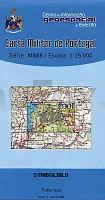
![]() | 374 - Topographische Landkarte Portugal 1:25.000 Carta Militar de Portugal - Série M888 Instituto Geográfico do Exército (IGeoE) - Portugal |
![]() | Parco Naturale dell`Aveto - S. Stefano - Rezzoaglio - Borzonasca - Provincia di Genova (Blatt GE-7) Carta dei Sentieri Topographische Wanderkarte 1:25.000 EdM - Edizioni del Magistero - Italien |
![]() | Hamont-Achel Wanderkarte - 7 Wanderungen Touristische Landkarte und Wanderkarte NGI Belgien |
![]() | 5804 Schönecken - Wanderkarte mit Wanderwegen (geplottete Ausgabe) ProjektNord - Grundlage Amtliche topographische Karte Landesamt für Vermessung und Geobasisinformation Rheinland-Pfalz |
![]() | 6010 Kirchberg (Hunsrück) - Wanderkarte mit Wanderwegen (geplottete Ausgabe) ProjektNord - Grundlage Amtliche topographische Karte Landesamt für Vermessung und Geobasisinformation Rheinland-Pfalz |
![]() | 207 - Topographische Landkarte Portugal 1:25.000 Carta Militar de Portugal - Série M888 Instituto Geográfico do Exército (IGeoE) - Portugal |
![]() | O10 Starnberg - mit Gauting, Germering, Gilching, Seefeld, Herrsching a.Ammersee *** SCHNÄPPCHEN *** ATK25 Topographische Karte 1:25.000 (Atkis) Bayern Landesvermessungsamt Bayern - Wanderkarte |
![]() | L7532 Schrobenhausen (gedruckte Ausgabe) Topographische Karte Bayern 1:50.000 Bayerisches Landesvermessungsamt |
![]() | 561 Odemira (Süd) Topographische Landkarte Portugal 1:25.000 Carta Militar de Portugal - Série M888 Instituto Geográfico do Exército (IGeoE) - Portugal |
![]() | U5423 Puitsitunturi Topographische Karte 1:25.000 EUREF (Peruskartta) Maanmittauslaitos / Lantmäteriverket Finnland - ProjektNord |
![]() | 4655/56 Rothenburg/OL Nieder-Neundorf - Geologische Karte 1:25.000 (GK25) Grundlage Messtischblatttopographie Sächsisches Landesamt für Umwelt, Landwirtschaft und Geologie |
![]() | 3142 Fehrbellin Sonderausgabe mit Wanderwegen - Topographische Wanderkarte Brandenburg 1:25.000 ProjektNord |
![]() | 0899 GUADALCANAL Topographische Landkarte 1:50.000 Spanien (Grundlage MTN50) Instituto Geográfico Nacional - CNIG Spanien - ProjektNord |
![]() | Usedom Kartenset 3 Rad- und Wanderkarten 1:30.000 (Zinnowitz - Ückeritz - Peenemünde, Heringsdorf - Ahlbeck - Bansin, Lieper Winkel und Usedom) - Grünes Herz |
![]() | 105/123 Kantiemov / Novopskov - Amtliche topographische Landkarte 1:100.000 der Ukraine Kiewskaja Wojenno-Kartografitscheskaja Fabrika Ukraine |
![]() | 5104 Düren (geplottete Ausgabe) Amtliche topographische Karte 1:25.000 Landesvermessungsamt Nordrhein-Westfalen |


