| << Portugal: Amtliche topografische Landkarten des Instituto Geográfico do Exército (IGeoE) 1:25.000 (Serie M888) |
||
|
||

Zuletzt angesehene Artikel:
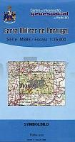
 | 355 - Topographische Landkarte Portugal 1:25.000 Carta Militar de Portugal - Série M888 Instituto Geográfico do Exército (IGeoE) - Portugal |
 | 3213 (NL 33-01-13) Kufstein Topographische Wanderkarte 1:50.000 mit Wegmarkierungen - Ãsterreich - Kartographie BEV - ProjektNord |
 | 3138 Hansestadt Havelberg Sonderausgabe mit Wanderwegen - Topographische Wanderkarte Brandenburg 1:25.000 ProjektNord |
 | 3245 Oranienburg Sonderausgabe mit Wanderwegen - Topographische Wanderkarte Brandenburg 1:25.000 ProjektNord |
 | 570 Pereiras-Gare (Odemira) Topographische Landkarte Portugal 1:25.000 Carta Militar de Portugal - Série M888 Instituto Geográfico do Exército (IGeoE) - Portugal |
 | W521 Partakko Topographische Karte 1:50.000 EUREF-FIN (Maastokarttat) Maanmittauslaitos / Lantmäteriverket Finnland - ProjektNord |
 | Pegli - Pra` - Piani di Praglia e Parco delle Capanne Marcarolo - Provincia di Genova (Blatt GE-9) Topographische Wanderkarte 1:25.000 Carta dei Sentieri EdM - Edizioni del Magistero - Italien |
 | 3317 (NM 33-10-17) Schärding Topographische Wanderkarte 1:50.000 mit Wegmarkierungen - Ãsterreich - Kartographie BEV - ProjektNord |
 | 321.2 Amtliche topographische Karte 1:50.000 Polen |
 | Peking Reiseführer (englisch) Porträt einer GroÃstadt Beijing - Portrait of a City Odyssey Publications |
 | Isfahan - Touristische Landkarte - Provinz-StraÃenkarte 1:670.000 (Blatt 155) Landkarte / StraÃenkarte (englisch) The Tourism Map of Esfahan - اصفهان Iranshenasi - Iran |
| 322.34 Amtliche topographische Karte 1:25.000 Polen |
 | 3219 (NL 33-01-19) Neukirchen am GroÃvenediger Topographische Wanderkarte 1:50.000 mit Wegmarkierungen - Ãsterreich - Kartographie BEV - ProjektNord |
 | 106E14 Topographische Landkarte 1:50.000 - Canada - Yukon Territory |
 | 4305 (NM 33-11-05) Raabs an der Thaya Topographische Wanderkarte 1:50.000 mit Wegmarkierungen - Ãsterreich - Kartographie BEV - ProjektNord |
 | 3224 (NL 33-01-24) Schladming Topographische Wanderkarte 1:50.000 mit Wegmarkierungen - Ãsterreich - Kartographie BEV - ProjektNord |
| 3441-SO Topographische Karte 1:10.000 - Landesvermessungsamt Brandenburg |
 | 5141 Nationalpark Triglav - Kranjska Gora - Planica - Bled 1:35.000 - Wanderkarte mit Begleitheft - GPS - Freytag & Berndt |
 | 3 II Aveleda Topographische Landkarte Portugal 1:50.000 Carta Militar de Portugal Instituto Geográfico do Exército (IGeoE) - Portugal |
 | 3047 Groà Schönebeck Sonderausgabe mit Wanderwegen - Topographische Wanderkarte Brandenburg 1:25.000 ProjektNord |