| << Portugal: Amtliche topografische Landkarten des Instituto Geográfico do Exército (IGeoE) 1:25.000 (Serie M888) |
||
|
||

Zuletzt angesehene Artikel:
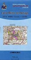
 | 348 Marvao Topographische Landkarte Portugal 1:25.000 Carta Militar de Portugal - Série M888 Instituto Geográfico do Exército (IGeoE) - Portugal |
 | 0805-3 VALLE DE LA SERENA Topographische Landkarte 1:25.000 Spanien (Grundlage MTN25) Instituto Geográfico Nacional - CNIG Spanien - ProjektNord |
 | K3421 Vänö Topographische Karte 1:25.000 EUREF (Peruskartta) Maanmittauslaitos / Lantmäteriverket Finnland - ProjektNord |
 | 3744 Wildenbruch Sonderausgabe mit Wanderwegen - Topographische Wanderkarte Brandenburg 1:25.000 ProjektNord |
 | Atlas des unteren Amur - Chabarowsk - Nikolajewsk am Amur 1:100.000 (kyrillisch) Autoatlas, StraÃenatlas Atlas Nizhnewo Amura - Habarowsk - Nikolaewsk-na-Amure Topograficheskie karty Dal`newostochnyj Federal`nyj Okrug - Russland |
 | 8425 Weiler-Simmerberg Topographische Landkarte Bayern 1:25.000 - Normalausgabe - ProjektNord (geplottete Ausgabe) - Grundlage amtliche Topographische Karte Bayern DTK25 |
 | Rad- und Wanderkarte Rerik - Kühlungsborn 1:30.000 Heiligendamm, Neubukow und Kröpelin - grünes herz |
 | Jakobsweg - Camino del Norte *** SCHNÃPPCHEN *** Cordula Rabe Wanderführer - Bergverlag Rother |
 | 3318 (NM 33-10-18) Rohrbach in Oberösterreich Topographische Wanderkarte 1:50.000 mit Wegmarkierungen - Ãsterreich - Kartographie BEV - ProjektNord |
 | 10138 Lødingen Topographische Landkarte 1:50.000 Norge-serien - Nordeca Norwegen |
 | 8134 Königsdorf Topographische Landkarte Bayern 1:25.000 - Normalausgabe - ProjektNord (geplottete Ausgabe) - Grundlage amtliche Topographische Karte Bayern DTK25 |
 | N4221 Kontiainen Topographische Karte 1:25.000 EUREF (Peruskartta) Maanmittauslaitos / Lantmäteriverket Finnland - ProjektNord |
 | N5411 Vihtari Topographische Karte 1:25.000 EUREF (Peruskartta) Maanmittauslaitos / Lantmäteriverket Finnland - ProjektNord |
 | MARCO POLO Regionalkarte Costa Brava / Pyrenäen / Baskenland / Navarra / Aragon / Andorra / Kantalonien Baskenland, Navarra, Aragon, Andorra, Kantalonien |
 | Urgell (Blatt 38) 1:50.000 Wanderkarte Spanien - ICC - Institut Cartogrà fic de Catalunya |
 | 02-34-07 Topographische Karte 1:10.000 der Tschechischen Republik Zakladnà mapa Ceská republika - Cesky urad zememericky a katastralni - ProjektNord |
 | U4244 Levijoki Topographische Karte 1:25.000 EUREF (Peruskartta) Maanmittauslaitos / Lantmäteriverket Finnland - ProjektNord |
 | Elbewasserstrasse und Elberadweg von Decin (Tetschen) bis MeiÃen (Blatt 1) Rad- und Gewässerkarte 1:50.000 - Pharus Verlag |
 | 114 Alto Garda - Valle di Ledro 1:25.000 Mountainbike- und Wanderkarte - 4land Italien |
 | V4234 Käkkälöjoki Topographische Karte 1:25.000 EUREF (Peruskartta) Maanmittauslaitos / Lantmäteriverket Finnland - ProjektNord |